Line © OpenStreetMap contributors (ODbL), checked by Global Adventurer.
The walk
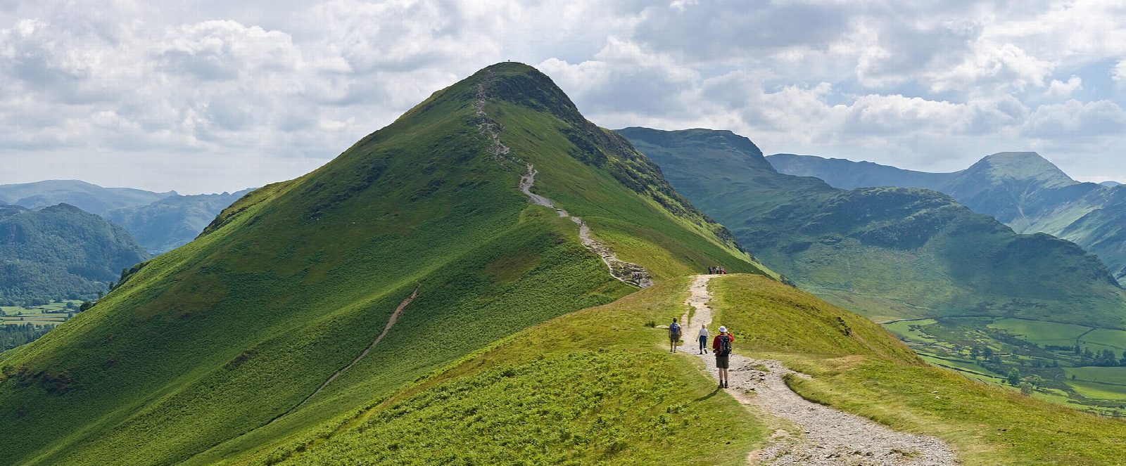
The walk starts from a car park near Hawes End and makes a circuit. It climbs the north ridge of Catbells, by Skelgill Bank, to the summit (451 m), then drops to Hause Gate and down to the shore of Derwent Water, returning through the woods of Brandelhow by Brandelhow Bay. It is on path nearly all the way, with a short stretch of road.
It is 6.5 km with 408 m of ascent; allow about 3 hours. The grade is Easy: it is short and the paths are clear, though the climb up the ridge is steep in places.
Catbells is the most popular small fell in the Lake District, so expect company on the ridge. It is still open to the weather, and the ridge is no place to linger in high wind or mist, so check the forecast. Brandelhow, on the way back, was the National Trust's first Lake District purchase, in 1902. There are no mapped water sources on the route.
The car park is near Hawes End, at the foot of the north ridge.
Route drawn by Global Adventurer along OpenStreetMap paths (© OpenStreetMap contributors, ODbL), with figures worked out from it. Check the forecast and the ground on the day: paths change.
Good to know
- The most popular small fell in the Lake District
- Up the north ridge, back along the wooded shore of Derwent Water through Brandelhow
- Brandelhow was the National Trust's first Lake District purchase, in 1902
Summits on the way
- Skelgill Bank 338 m · passed close by
- Cat Bells [Catbells] 451 m
Getting there
Start: Hawes End. 54.58090, -3.16600
Places to stay nearby
Rooms in and around Aspatria: Booking.com → Expedia →
Affiliate links: if you book, Global Adventurer earns a small commission at no cost to you.
Paths change, and the weather decides the day. The line and figures come from OpenStreetMap and our own checks; take a map, check the forecast, and turn back if it isn't right.


