Line © OpenStreetMap contributors (ODbL), checked by Global Adventurer.
The walk
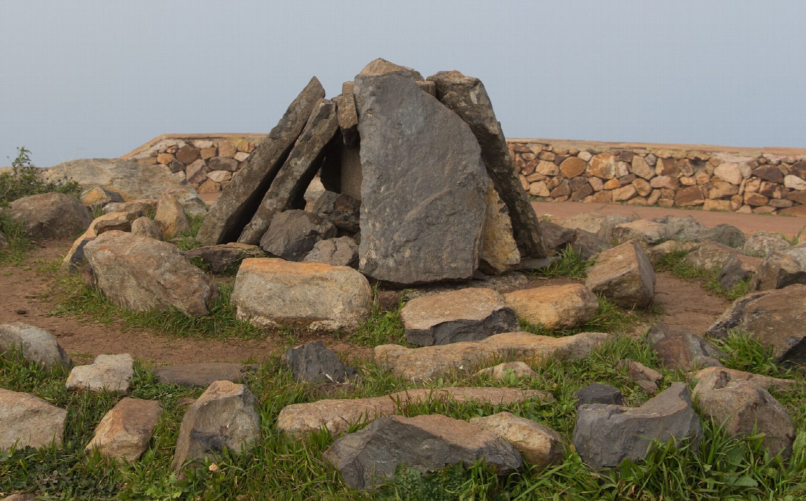
From the El Contadero car park, on the road across the top of the island, a path climbs through tree heath and young laurel, growing back after the fire of 2012, to the Alto de Garajonay, 1,487 m. The summit, where the first Gomerans had their altars of sacrifice, is a round platform of stone. On a clear day Tenerife, La Palma, El Hierro and Gran Canaria all stand above the sea of cloud. Come down by the forest track, which loops back to the car park.
It is 2.5 km round with 105 m of climbing; allow about an hour. The grade is Easy: a short, steady climb on a good path and an easy track.
The summit is often in cloud, and it can be cold, wet and windy even in summer: take a waterproof. The national park asks for closed footwear, and closes all its paths when there is a strong-wind alert.
No permit is needed. There is no phone coverage in much of the park, and no water on the way.
Route drawn by Global Adventurer along OpenStreetMap paths (© OpenStreetMap contributors, ODbL), with figures worked out from it. Check the forecast and the ground on the day: paths change.
Good to know
- The top of La Gomera, 1,487 m, a place of sacrifice for the first islanders
- On a clear day Tenerife, La Palma, El Hierro and Gran Canaria are all in view
- Heath and laurel growing back after the fire of 2012
- Often in cloud: cool, damp and windy even in summer
Summits on the way
- Alto de Pajarito 1,469 m · passed close by
- Alto de Garajonay 1,483 m
Getting there
Start: El Contadero · Free parking. 28.11568, -17.24329
Places to stay nearby
Rooms in and around La Gomera: Booking.com → Expedia →
Affiliate links: if you book, Global Adventurer earns a small commission at no cost to you.
Paths change, and the weather decides the day. The line and figures come from OpenStreetMap and our own checks; take a map, check the forecast, and turn back if it isn't right.