Line © OpenStreetMap contributors (ODbL), checked by Global Adventurer.
The walk
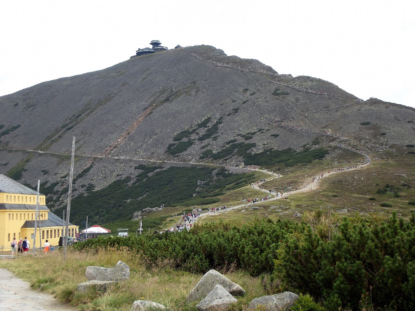
From the car park on ul. Olimpijska in Karpacz, walk east through the town to Wilcza Poręba and take the yellow path up the Łomniczka valley, past the Betonowy Most bridge, to the Schronisko Nad Łomniczką hostel. The red path climbs steeply on stone steps through Kocioł Łomniczki, a glacial cirque, to the Dom Śląski hostel on the pass below Śnieżka. Climb the zigzag path to the summit, 1,603 m, with its saucer-shaped observatory, then come down the gentler Droga Jubileuszowa to Dom Śląski. The black path leads over Kopa and down past Kocioł Białego Jaru to Karpacz.
It is 15.7 km with 931 m of ascent; allow about 7 hours. The grade is Hard: a long climb on stone paths, steep in Kocioł Łomniczki.
The zigzag path is for going up only; the way down is the Droga Jubileuszowa. The summit is bare and often in cloud and strong wind. Each winter the park closes the path through Kocioł Łomniczki and the Droga Jubileuszowa for avalanche danger. Walking after dark is not allowed. Entry to the Karkonosze National Park costs 11 zł (2026), and dogs are not allowed on the path through Kocioł Łomniczki.
Karpacz's town car parks cost 8 zł an hour or 40 zł a day.
Route drawn by Global Adventurer along OpenStreetMap paths (© OpenStreetMap contributors, ODbL), with figures worked out from it. Check the forecast and the ground on the day: paths change.
Good to know
- Śnieżka, 1,603 m, on the Polish-Czech border, is the highest mountain in the Sudetes, with the saucer-shaped observatory on its top
- Up the Łomniczka valley and the steep stone path through Kocioł Łomniczki, a glacial cirque, to the Dom Śląski hostel
- The zigzag path from Dom Śląski to the summit is up only; the way down is the gentler Droga Jubileuszowa
- The paths through Kocioł Łomniczki and along the Droga Jubileuszowa are closed in winter
Summits on the way
- Gozdowa 785 m · passed close by
- Śnieżka / Sněžka 1,603 m
Getting there
Start: Karpacz car park, ul. Olimpijska · Pay and display. 50.76960, 15.73716
Places to stay nearby
Rooms in and around Karpacz car park: Booking.com → Expedia →
Affiliate links: if you book, Global Adventurer earns a small commission at no cost to you.
Paths change, and the weather decides the day. The line and figures come from OpenStreetMap and our own checks; take a map, check the forecast, and turn back if it isn't right.