Line © OpenStreetMap contributors (ODbL), checked by Global Adventurer.
The walk
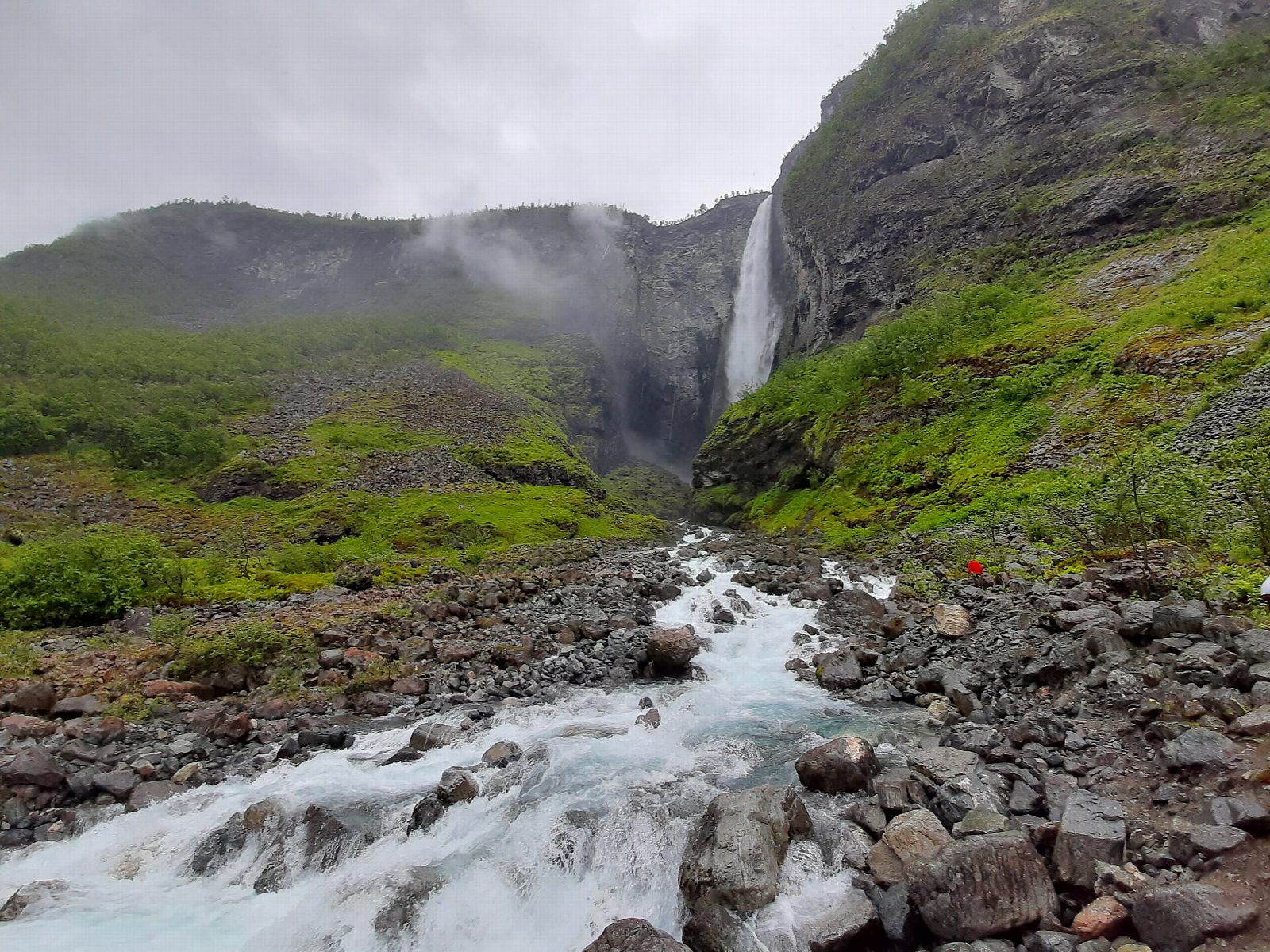
From the car park at Hjelle, at the end of the road into Utladalen, follow Folkevegen, the old farm road now closed to cars, up the valley beside the Utla. In about an hour it reaches Vetti gard, a farm that takes in walkers in summer. Beyond the farm the marked path crosses the river on a suspension bridge, and a path leads on up to a viewpoint below Vettisfossen, which falls 275 m free from the lip of the cliff. Return the same way.
It is 13.2 km there and back with 515 m of ascent; allow about 4½ hours. The grade is Moderate: a long valley walk, mostly on a broad road, with a rougher path at the end.
Årdal Turlag gives the season as June to September; in early summer the Utla runs high and loud with snowmelt. DNT Oslo og Omegn says the fall can also be seen from above, from a platform at Vettismorki on the marked route towards Ingjerdbu, which makes a much longer and harder day.
Parking at Hjelle is free. Folkevegen is a closed toll road that can be cycled, and a bus runs to Hjelle in summer.
Route drawn by Global Adventurer along OpenStreetMap paths (© OpenStreetMap contributors, ODbL), with figures worked out from it. Check the forecast and the ground on the day: paths change.
Good to know
- Vettisfossen is Norway's highest unregulated waterfall, a free fall of 275 m
- Along Folkevegen, a farm road closed to cars, to Vetti gard, about an hour from Hjelle
- Vetti gard is a summer farm with food and beds
- The Utla runs high and loud with snowmelt in early summer
Getting there
Start: Hjelle · Free parking. 61.34269, 7.87788
Places to stay nearby
Rooms in and around Jotunheimen: Booking.com → Expedia →
Affiliate links: if you book, Global Adventurer earns a small commission at no cost to you.
Paths change, and the weather decides the day. The line and figures come from OpenStreetMap and our own checks; take a map, check the forecast, and turn back if it isn't right.