Line © OpenStreetMap contributors (ODbL), checked by Global Adventurer.
The walk
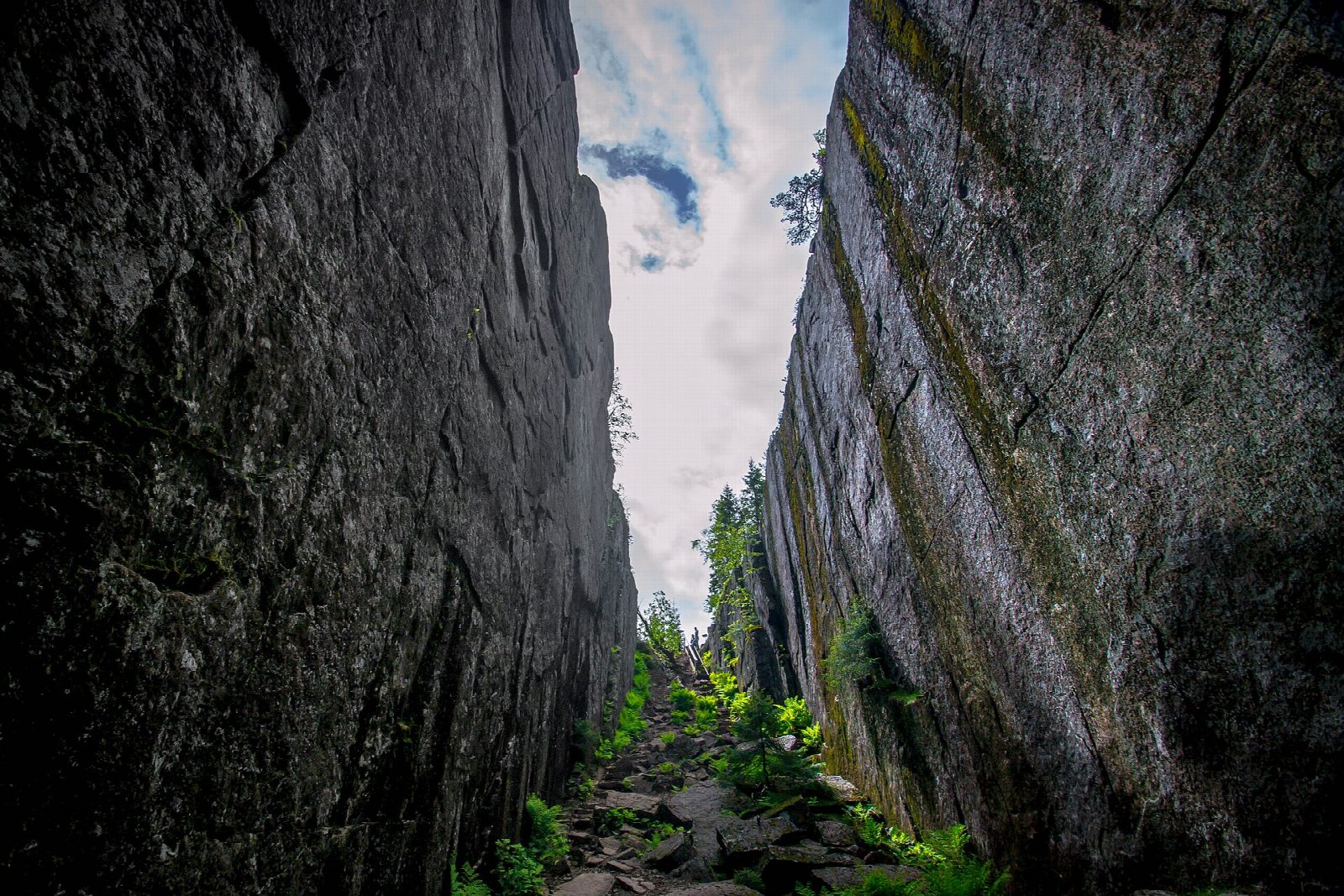
From Entré Syd, the southern entrance to Skuleskogen National Park, boardwalks lead north through the forest and over wet ground, then the path climbs into Slåttdalen, the valley below Slåttdalsberget. It goes on along the west side of Slåttdalsskrevan, on boardwalks and rock, to the north end of the cleft, where you can look down its length between walls 30 m high, only 7 m apart. Return the same way.
It is 7 km there and back with 192 m of ascent; allow about 2½ hours. The grade is Easy, but the ground is rough: roots, rock and some steep climbs.
The passage through the cleft has been closed since June 2023 because of falling rock; the path now runs round its west side. The national park says many of its paths are steep and demanding. Dogs must be on a lead all year, and fires are allowed only at the set places from 1 May to 30 September. There is no drinking water at the entrances, so bring your own. Snow can lie into May.
Entré Syd is signed from the E4 about 2 km north of Docksta, then 8 km along a minor road. The car park closes to cars when it is full, which in summer 2026 happened almost every day for weeks.
Route drawn by Global Adventurer along OpenStreetMap paths (© OpenStreetMap contributors, ODbL), with figures worked out from it. Check the forecast and the ground on the day: paths change.
Good to know
- Slåttdalsskrevan is a cleft 200 m long, 30 m deep and 7 m wide in the granite of Skuleskogen National Park
- Since June 2023 the passage through the cleft has been closed because of falling rock; the path goes round its west side
- Dogs must be on a lead in the park all year; fires only at the set places from 1 May to 30 September
- There is no drinking water at the park entrances
Getting there
Start: Skuleskogen Entré Syd · Free parking. 63.08406, 18.47847
Places to stay nearby
Rooms in and around High Coast: Booking.com → Expedia →
Affiliate links: if you book, Global Adventurer earns a small commission at no cost to you.
Paths change, and the weather decides the day. The line and figures come from OpenStreetMap and our own checks; take a map, check the forecast, and turn back if it isn't right.