Line © OpenStreetMap contributors (ODbL), checked by Global Adventurer.
The hike
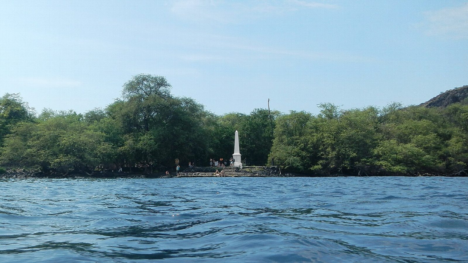
The walk starts at the Kaʻawaloa trailhead on Nāpōʻopoʻo Road, a short way below its junction with Highway 11 at Captain Cook; parking is on the roadside only. The trail, an old cart road of the 1820s, drops between walls of tall grass and then across open lava with the bay below. At the bottom it reaches Kaʻawaloa, the flat at the north end of Kealakekua Bay, and runs through the trees to the Cook Monument, a white obelisk of 1874 beside the water of Kaʻawaloa Cove. Return the same way.
It is 3.7 miles (6.0 km) round trip with 1,270 feet (387 m) of climbing; allow about 3 hours. The grade is Hard: downhill all the way out, then a hot, shadeless climb of 1,300 feet back to the road.
Kealakekua Bay State Historical Park is open from 7 am to 8 pm and charges nothing. Walkers need no permit; the permits are for boats. There are no toilets and no water on the trail or at the monument, so carry plenty, start early and pack out your rubbish.
The trailhead is in a neighbourhood: park well off the road and do not block driveways. At the bay, stay off the old stone platforms and respect the kapu signs, and keep at least 50 yards from dolphins.
Route drawn by Global Adventurer along OpenStreetMap paths (© OpenStreetMap contributors, ODbL), with figures worked out from it. Check the forecast and the ground on the day: paths change.
Good to know
- Down an old path through grass and kiawe to Kealakekua Bay, where Captain Cook was killed in 1779
- A white obelisk of 1874 stands by the clear water of a marine reserve
- About 1,300 feet back up in hot, open country: start early and carry plenty of water. Roadside parking only
Getting there
Start: Kaʻawaloa Trailhead, Nāpōʻopoʻo Road. 19.49221, -155.91801
Places to stay nearby
Rooms in and around Kaʻawaloa Trailhead: Booking.com → Expedia →
Affiliate links: if you book, Global Adventurer earns a small commission at no cost to you.
Paths change, and the weather decides the day. The line and figures come from OpenStreetMap and our own checks; take a map, check the forecast, and turn back if it isn't right.
