Line © OpenStreetMap contributors (ODbL), checked by Global Adventurer.
The walk
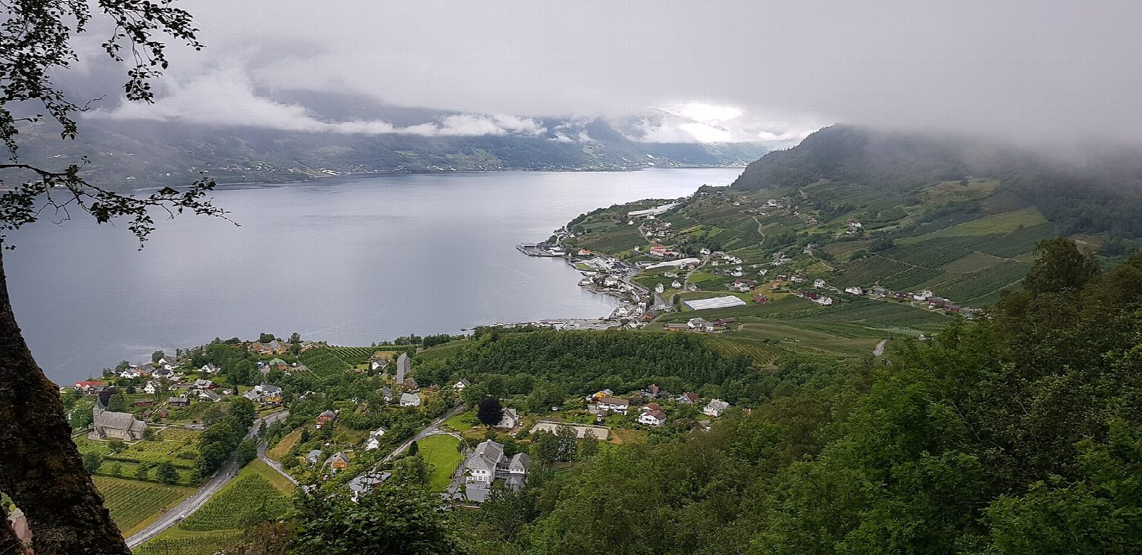
From the car park on the road up to Røte and Vassmyrane, above Kinsarvik, follow the gravel road and a tractor road up to Heng, at about 890 m, where the marked path begins. It passes small lakes and the deer and elk crossing at Ulvskjaft to Duk, a huge cairn at about 1,100 m, then turns sharply at Rjukande, where the river runs through a narrow cleft. Past the landmark of Nosi come the Munketreppene (the monks' steps), said to have been built by Cistercian monks between 1210 and 1537, and paths and tractor roads wind down through the orchards to Lofthus.
It is 14.8 km with 922 m of ascent and 1,201 m of descent; allow about 7½ hours. The grade is Hard: a long day with a steep, rough descent of more than 1,000 m.
The path was opened by Queen Sonja in 2013 and is marked with a blue D. Bergen og Hordaland Turlag gives the season as May to October and says you cannot ski down to Lofthus.
The private road to Røte has a 200 kr toll that covers parking. The turlag asks walkers not to park in Lofthus; a shuttle bus, booked ahead, runs from Lofthus back to Røte or Kinsarvik.
Route drawn by Global Adventurer along OpenStreetMap paths (© OpenStreetMap contributors, ODbL), with figures worked out from it. Check the forecast and the ground on the day: paths change.
Good to know
- A path opened by Queen Sonja in 2013 and marked with a blue D, high above the Sørfjorden
- Past the cairn at Duk, the gorge at Rjukande and the landmark of Nosi, then down the Munketreppene, steps said to have been built by monks between 1210 and 1537
- Road toll and parking at Røte cost 200 kr; parking in Lofthus is discouraged
- A shuttle bus runs from Lofthus back to Røte or Kinsarvik and must be booked
Getting there
Start: Røte. 60.37457, 6.69563
Places to stay nearby
Rooms in and around Hardanger: Booking.com → Expedia →
Affiliate links: if you book, Global Adventurer earns a small commission at no cost to you.
Paths change, and the weather decides the day. The line and figures come from OpenStreetMap and our own checks; take a map, check the forecast, and turn back if it isn't right.