Line © OpenStreetMap contributors (ODbL), checked by Global Adventurer.
The walk
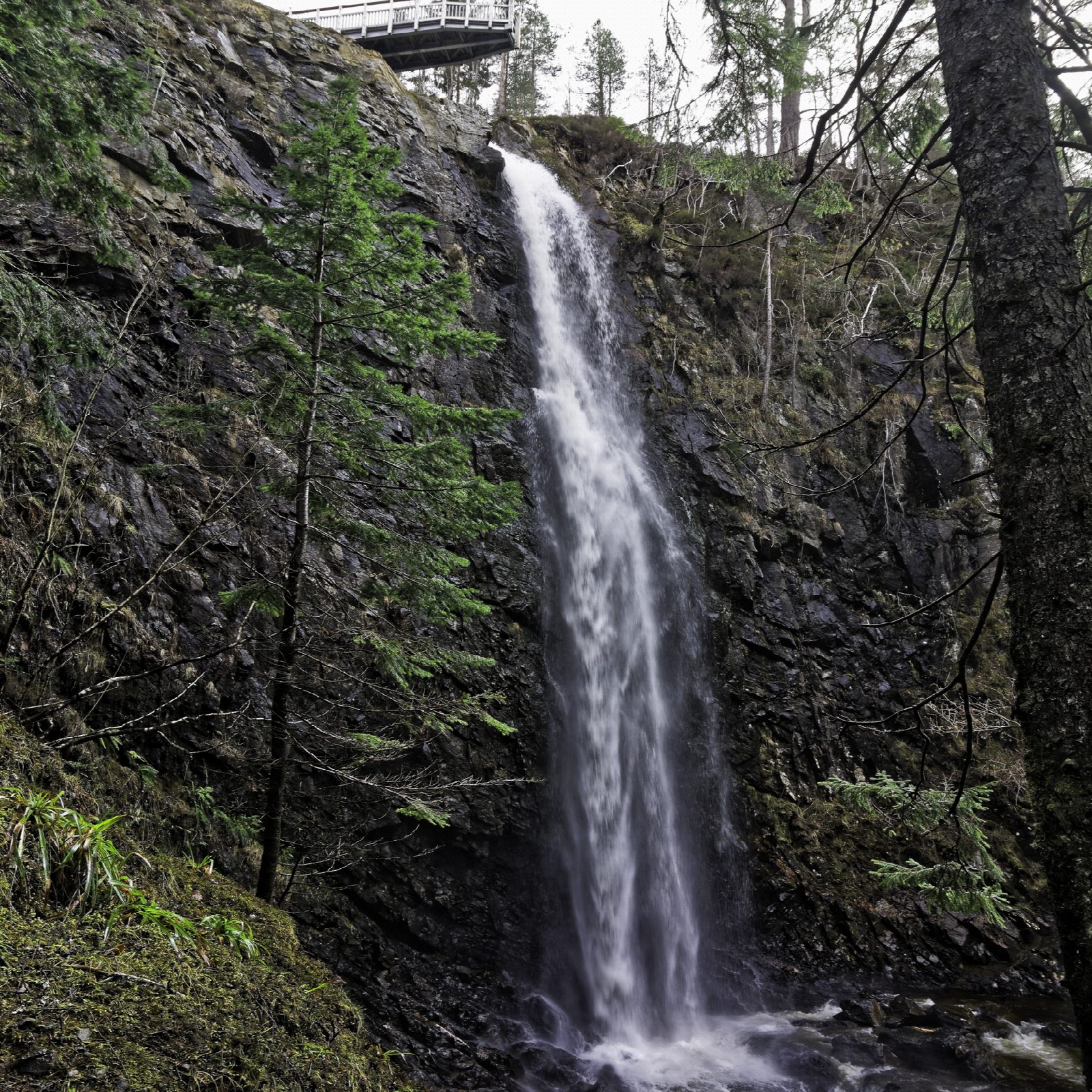
From the Plodda Falls car park, at the end of the forest road beyond Tomich, the Tweedmouth Trail heads north on a path through tall Douglas firs and drops to the riverside below Plodda Cottage. It then follows the Abhainn Deabhag upstream. A side path leads down to the foot of the falls, where the water plunges around 40 m into a twisting gorge. Steps climb to the top of the falls and a viewing platform built out over the lip, where Lord Tweedmouth put a bridge in 1880. A short path leads back to the car park.
It is 2.6 km with 90 m of ascent; allow about 1 hour. The grade is Easy: a short walk, but with steep slopes, stone steps and narrow paths that can be muddy.
The firs were planted by Lord Tweedmouth on his Guisachan estate, and some are among the tallest trees in Scotland. Forestry and Land Scotland warns of uneven earth paths, exposed roots and several flights of steps. When the river is high, spray soaks anyone at the foot of the falls.
The car park charges (£2 an hour, £5 for the day; the ticket is valid at the Glen Affric car parks too). The last 2.8 km from Tomich is a narrow, rough forest road. There is no public transport to the start.
Route drawn by Global Adventurer along OpenStreetMap paths (© OpenStreetMap contributors, ODbL), with figures worked out from it. Check the forecast and the ground on the day: paths change.
Good to know
- Plodda Falls drops around 40 m into the gorge of the Abhainn Deabhag
- A viewing platform hangs over the lip of the falls, where Lord Tweedmouth built a bridge in 1880
- The Douglas firs were planted by Lord Tweedmouth on his Guisachan estate; some are among the tallest trees in Scotland
Getting there
Start: Plodda Falls car park, above Tomich · Pay and display. 57.27245, -4.85448
Places to stay nearby
Rooms in and around Plodda Falls car park: Booking.com → Expedia →
Affiliate links: if you book, Global Adventurer earns a small commission at no cost to you.
Paths change, and the weather decides the day. The line and figures come from OpenStreetMap and our own checks; take a map, check the forecast, and turn back if it isn't right.