Line © OpenStreetMap contributors (ODbL), checked by Global Adventurer.
The hike
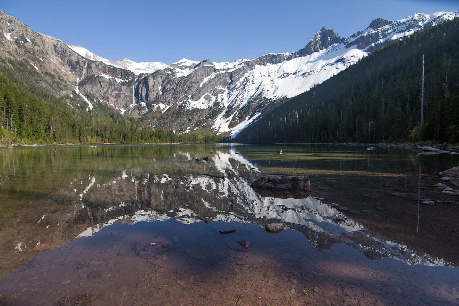
The walk starts at the Trail of the Cedars parking on Going-to-the-Sun Road, by the Avalanche picnic area and campground. Take the Trail of the Cedars, a level boardwalk through old cedars and hemlocks beside Avalanche Creek, for half a mile to the footbridge at Avalanche Gorge, where the creek pours through a narrow slot in the rock. Just beyond, the Avalanche Lake Trail turns off and climbs through forest above the creek, steeper and rocky at first, to the foot of Avalanche Lake, with waterfalls coming down the cliffs at its head. Return the same way.
It is 4.4 miles (7.1 km) round trip with 660 feet (200 m) of climbing; allow about 2½ hours. The grade is Easy: a steady climb on a good, busy trail.
On October 1, 2026 the park had this trail posted for bears frequenting it, with muddy and flooded patches. Carry bear spray, make noise and hike in a group. Stay back from Avalanche Creek: the park says water is the leading cause of deaths in Glacier. Pets are not allowed on the trail.
No vehicle reservation is needed to enter Glacier in 2026, and the park shuttle does not serve Avalanche this year, so come by car and come early. In winter Going-to-the-Sun Road is kept open only as far as Lake McDonald Lodge, short of Avalanche.
Route drawn by Global Adventurer along OpenStreetMap paths (© OpenStreetMap contributors, ODbL), with figures worked out from it. Check the forecast and the ground on the day: paths change.
Good to know
- Along the Trail of the Cedars boardwalk past Avalanche Gorge, then up through old forest
- Waterfalls stream down the cliffs above the lake, fed by the snow and ice of Sperry Glacier
- The car parks on Going-to-the-Sun Road fill early in summer: start early or late
Getting there
Start: Avalanche Picnic Area. 48.68086, -113.81901
Places to stay nearby
Rooms in and around Glacier National Park: Booking.com → Expedia →
Affiliate links: if you book, Global Adventurer earns a small commission at no cost to you.
Paths change, and the weather decides the day. The line and figures come from OpenStreetMap and our own checks; take a map, check the forecast, and turn back if it isn't right.
