Line © OpenStreetMap contributors (ODbL), checked by Global Adventurer.
The walk
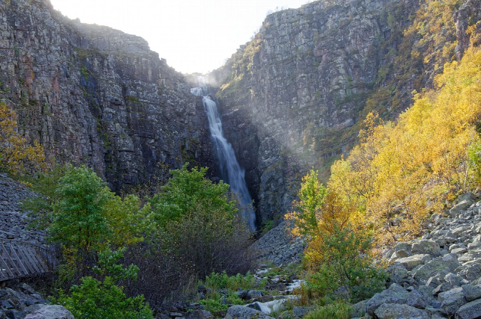
From the car park at Njupeskärsentrén, by Naturum Fulufjället, follow the yellow markers of Njupeskärsleden west on wide boardwalks across mire and through forest on the north side of the river Njupån. The path climbs gently past the rest cabin Njupeskärsstugan to the viewing platform below Njupeskär, where the water falls 93 m, 70 m of it in a single drop, down the wall of the ravine. The way back follows the south side of the Njupån to the car park.
It is 4.2 km round with 98 m of ascent; allow about 1½ hours. The grade is Easy: packed gravel and boardwalks, steep in places near the falls.
The national park closes the last stretch into the ravine in winter and spring because of avalanches and falling ice, snow and rock; then you can see the falls from Njupeskärsstugan. Snow can come as early as October and lie in places on the path into June. Dogs must be on a lead everywhere in the park, all year.
The car park has toilets and drinking water, open day and night all year. It is about 25 km west of Särna; Dalatrafik bus 785 runs from Särna. The naturum is open daily until 4 October, then from 24 October to 1 November.
Route drawn by Global Adventurer along OpenStreetMap paths (© OpenStreetMap contributors, ODbL), with figures worked out from it. Check the forecast and the ground on the day: paths change.
Good to know
- Njupeskär is Sweden's highest waterfall, 93 m in all with a free fall of 70 m, in a ravine on the edge of the Fulufjället plateau
- The national park's yellow-marked Njupeskärsleden is about 4 km on packed gravel and wide boardwalks
- Dogs must be on a lead everywhere in the park, all year
- The last stretch into the ravine is closed in winter and spring because of avalanches and falling ice and rock
Getting there
Start: Njupeskär entrance car park. 61.63571, 12.71823
Places to stay nearby
Rooms in and around Fulufjället: Booking.com → Expedia →
Affiliate links: if you book, Global Adventurer earns a small commission at no cost to you.
Paths change, and the weather decides the day. The line and figures come from OpenStreetMap and our own checks; take a map, check the forecast, and turn back if it isn't right.