Line © OpenStreetMap contributors (ODbL), checked by Global Adventurer.
The walk
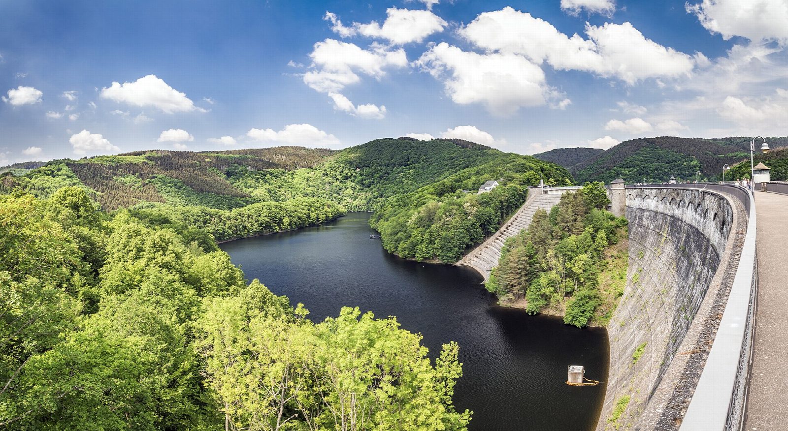
The walk starts on the lakeside at Einruhr and follows the east shore of the Obersee north, on a track closed to cars, round the wooded headland of Jägersweiler to the Urft dam, where there is a kiosk in season. It crosses the dam and returns along the foot of the Kermeter forest on a lakeside path to the Paulushof dam and Rurberg, crosses the Eiserbach dam, and comes back down the west side of the lake to Einruhr.
It is 15.3 km with 216 m of ascent; allow about 4½ hours. The grade is Moderate, for its length: the going is easy, nearly all on broad tracks, with no single big climb.
The Obersee is the upper basin of the Rursee. The Urft dam, finished in 1905, was the largest in Europe when it was built, and holds back a second lake that winds away into the national park.
There is no short cut except the boat. Boats call at Einruhr, Rurberg and the Urft dam from late March to the start of November; a single from the dam to Einruhr cost €11.50 in 2026. Buses 83 and SB63 run to Einruhr. In the national park keep to the marked paths, keep dogs on a lead, and light no fire.
Route drawn by Global Adventurer along OpenStreetMap paths (© OpenStreetMap contributors, ODbL), with figures worked out from it. Check the forecast and the ground on the day: paths change.
Good to know
- Round the Obersee, the upper basin of the Rursee, in Eifel National Park
- The Urft dam, finished in 1905, was the largest in Europe when it was built
- The east shore to the dam is closed to cars
- Boats call at Einruhr, Rurberg and the Urft dam from late March to early November
- In the national park: keep to the marked paths; dogs on a lead
Getting there
Start: Einruhr lakeside. 50.58373, 6.38005
Places to stay nearby
Rooms in and around Eifel: Booking.com → Expedia →
Affiliate links: if you book, Global Adventurer earns a small commission at no cost to you.
Paths change, and the weather decides the day. The line and figures come from OpenStreetMap and our own checks; take a map, check the forecast, and turn back if it isn't right.