Line © OpenStreetMap contributors (ODbL), checked by Global Adventurer.
The walk
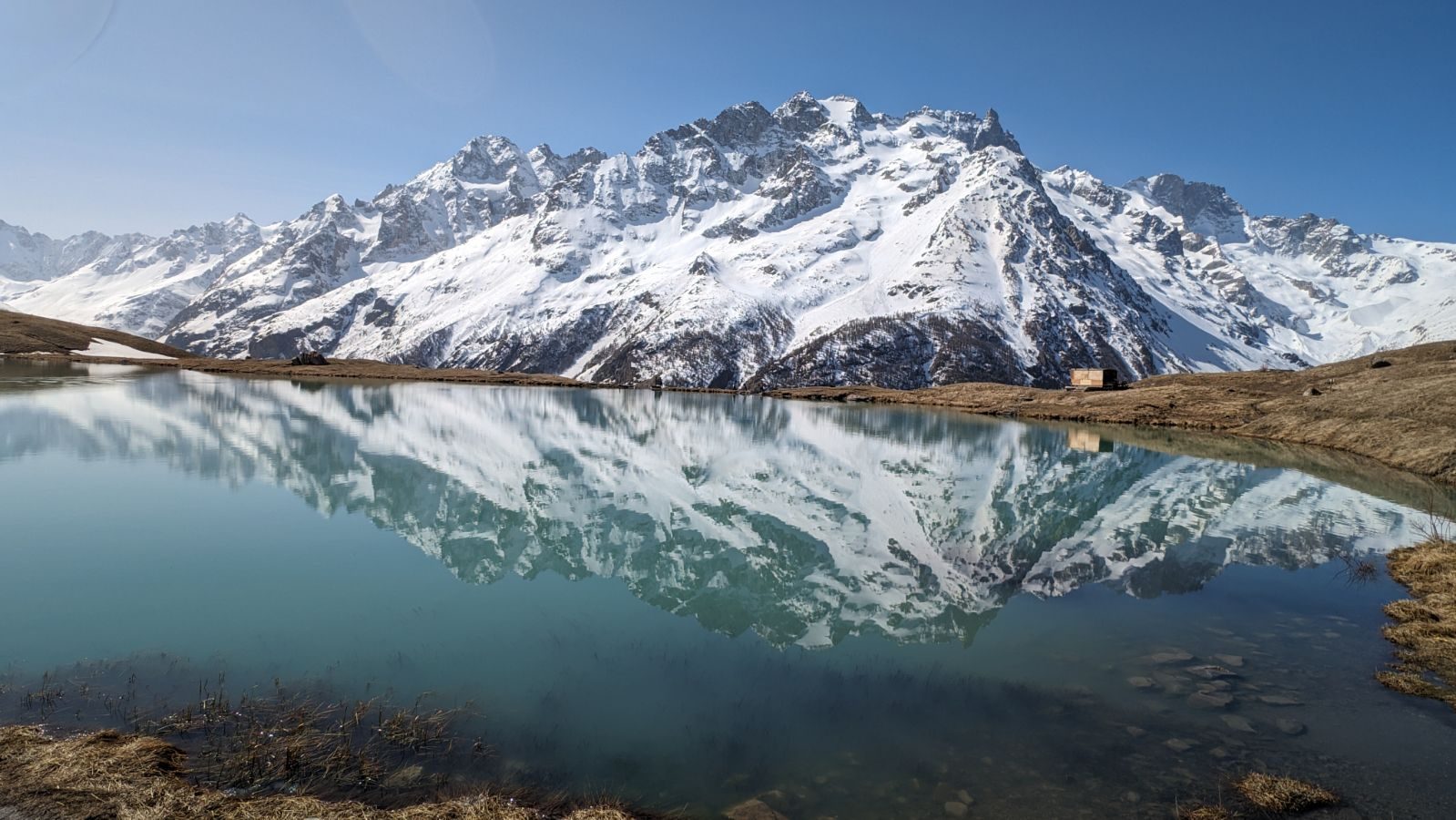
From the car park at the foot of Villar-d'Arène, walk up past the church and through the village to the main road. Cross it and take the lane up to the hamlet of Les Cours, go through it, and climb by an old path through the meadows to Lac du Pontet, at about 1,985 m. Across the Romanche valley stand the Meije and the glaciers of the Écrins. Walk round the lake, come down the broad track and the lane past the lake's car park, and take the path back down to the village.
It is 6.1 km round with 338 m of ascent; allow about 2½ hours. The grade is Easy: lanes, tracks and grassy paths, with one steady climb.
The park calls this an easy walk. Sheep graze the slopes in summer with guard dogs: do not walk through a flock, and keep away from the dogs. Take care crossing the main road through the valley.
The free car park is at the bottom of the village, reached from the main road between La Grave and the Col du Lautaret.
Route drawn by Global Adventurer along OpenStreetMap paths (© OpenStreetMap contributors, ODbL), with figures worked out from it. Check the forecast and the ground on the day: paths change.
Good to know
- Lac du Pontet, at about 1,985 m, looks across the Romanche valley to the Meije and the glaciers of the Écrins
- The park describes it as an easy walk up through the hamlet of Les Cours and back by the track and lane past the lake's car park
- There are sheep and guard dogs on the slopes: do not walk through the flocks
Getting there
Start: Villar-d'Arène lower car park. 45.04321, 6.33444
Places to stay nearby
Rooms in and around Écrins: Booking.com → Expedia →
Affiliate links: if you book, Global Adventurer earns a small commission at no cost to you.
Paths change, and the weather decides the day. The line and figures come from OpenStreetMap and our own checks; take a map, check the forecast, and turn back if it isn't right.