Line © OpenStreetMap contributors (ODbL), checked by Global Adventurer.
The walk
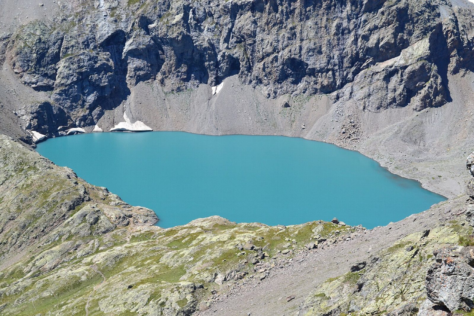
From the car park at Chambran, above Vallouise, follow the track towards the head of the valley, leaving a path to the Col de l'Eychauda on the right. After a big footbridge over a torrent the path passes a shepherd's hut and climbs slowly along the valley floor to the foot of a rock barrier. It then zigzags up a wide scree slope and flowery grass to a small shelf, and the lake appears behind its rock step, at about 2,514 m, in a glacial cirque under high ridges. Return the same way.
It is 11 km there and back with 790 m of ascent; allow about 5½ hours. The grade is Hard: a long climb on track and mountain path, stony in the zigzags.
The climb faces south-east and gets hot early, so start in good time; the park warns that a cold wind can come over the Col des Grangettes at the lake, so carry a warm layer. Ice can float on the lake well into summer. The walk is in the Parc national des Écrins.
The road to Chambran turns off at the hamlet of Le Sarret, between Vallouise and Pelvoux, and is closed in winter.
Route drawn by Global Adventurer along OpenStreetMap paths (© OpenStreetMap contributors, ODbL), with figures worked out from it. Check the forecast and the ground on the day: paths change.
Good to know
- A long valley walk, then a zigzag climb through scree and flowery grass to a milky glacial lake at about 2,514 m in a cirque under high ridges
- The climb faces south-east and gets hot early; a cold wind can blow over the Col des Grangettes at the lake
- The road to Chambran is closed in winter
Getting there
Start: Chambran car park. 44.90142, 6.49283
Places to stay nearby
Rooms in and around Écrins: Booking.com → Expedia →
Affiliate links: if you book, Global Adventurer earns a small commission at no cost to you.
Paths change, and the weather decides the day. The line and figures come from OpenStreetMap and our own checks; take a map, check the forecast, and turn back if it isn't right.