Line © OpenStreetMap contributors (ODbL), checked by Global Adventurer.
The walk
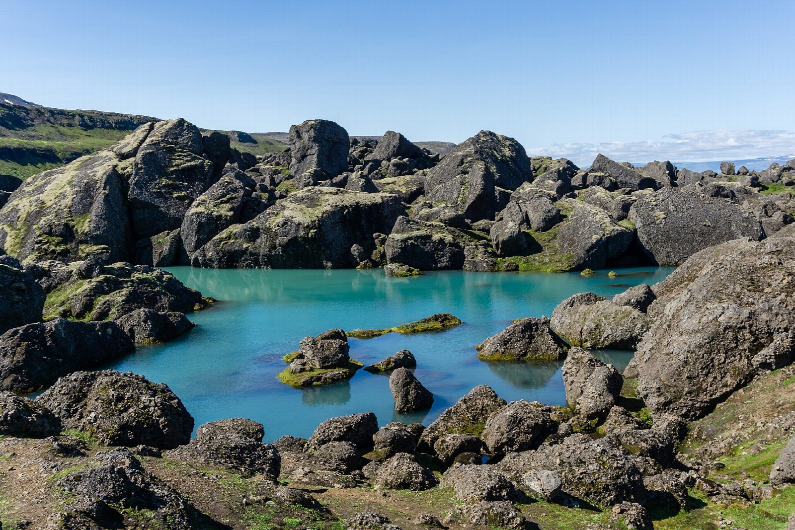
From the walking information house at Vatnsskarð, the pass on road 94 between Egilsstaðir and Borgarfjörður eystri, take the path south-east to join the trail marked with yellow stakes. Climb south over the moor and pass west of Súlur to the junction south of Mjóadalsvarp, below Dyrfjöll (the Door Mountains). Drop about 100 m into Stórurð (the great scree) and walk a short anticlockwise loop among giant boulders, grassy flats and blue-green ponds. Climb back out and return the same way.
It is 15 km there and back with 599 m of ascent; allow about 5½ hours. The grade is Moderate: a long staked path over high, open moorland, with a steep climb near the start and a drop of about 100 m into Stórurð and back up.
This is a summer walk. The Egilsstaðir tourist office gives mid-July to mid-September as the time to go. Outside those weeks expect snow over the stakes and poor visibility; snow can come at any time from October, and patches of it linger into July. The moor is high and exposed, with no shelter, and fog comes in fast: follow the yellow stakes.
Park by the information house at Vatnsskarð. Most people drive. OpenStreetMap shows a bus between Egilsstaðir and Borgarfjörður eystri over the pass, but we could not check its timetable.
Route drawn by Global Adventurer along OpenStreetMap paths (© OpenStreetMap contributors, ODbL), with figures worked out from it. Check the forecast and the ground on the day: paths change.
Good to know
- Stórurð, the great scree, is a hollow of giant boulders, grassy flats and blue-green ponds below Dyrfjöll
- The boulders are thought to have fallen from the mountains onto a glacier that later melted away
- Dyrfjöll, the Door Mountains, are named after the deep notch in their ridge
- Vatnsskarð is the pass on road 94 between Egilsstaðir and Borgarfjörður eystri
Summits on the way
- Geldingafjall 634 m · passed close by
Getting there
Start: Vatnsskarð car park. 65.56474, -14.00214
Places to stay nearby
Rooms in and around East Iceland: Booking.com → Expedia →
Affiliate links: if you book, Global Adventurer earns a small commission at no cost to you.
Paths change, and the weather decides the day. The line and figures come from OpenStreetMap and our own checks; take a map, check the forecast, and turn back if it isn't right.