Line © OpenStreetMap contributors (ODbL), checked by Global Adventurer.
The walk
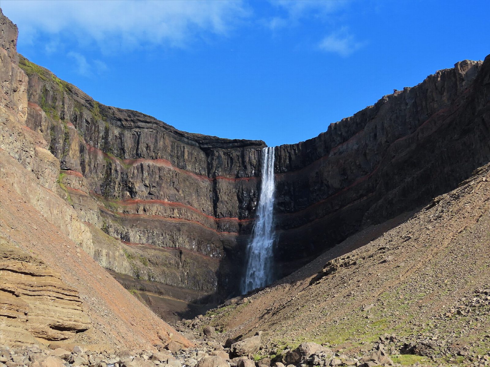
From the car park on road 933 in Fljótsdalur, climb the steps and follow the main path up the west bank of the Hengifossá gorge. About halfway up you pass Litlanesfoss, which falls between tall basalt columns. Higher up, the walls of the gorge are striped with red bands: old soils and ash, weathered between lava flows millions of years ago. Carry on into the gorge to the viewpoint facing Hengifoss, which drops about 128 m. Return the same way.
It is 4.6 km there and back with 249 m of ascent; allow about 2 hours. The grade is Easy: a steady climb all the way on a clear path, with steps above the car park.
The path is open all year, but icy patches in winter can be dangerous: take crampons or microspikes and check the forecast. The edges of the gorge are steep, so keep back from them, and stay out of the canyon itself, where rocks can fall. The gorge is on Iceland's nature conservation register, and rangers guide walks in summer.
Parking at the trailhead costs 1,000 ISK a car for the day in 2026, paid by card through Checkit. There is no bus. Drive from Egilsstaðir along Lagarfljót on roads 931 and 933, about 35 km.
Route drawn by Global Adventurer along OpenStreetMap paths (© OpenStreetMap contributors, ODbL), with figures worked out from it. Check the forecast and the ground on the day: paths change.
Good to know
- Hengifoss drops about 128 m into a gorge whose basalt walls are striped with red layers
- The red bands are old soils and ash, weathered between lava flows millions of years ago
- Litlanesfoss, halfway up, falls between tall basalt columns
- The path is open all year; it can be icy in winter
Getting there
Start: Hengifoss car park. 65.07330, -14.88114
Places to stay nearby
Rooms in and around East Iceland: Booking.com → Expedia →
Affiliate links: if you book, Global Adventurer earns a small commission at no cost to you.
Paths change, and the weather decides the day. The line and figures come from OpenStreetMap and our own checks; take a map, check the forecast, and turn back if it isn't right.