Line © OpenStreetMap contributors (ODbL), checked by Global Adventurer.
The walk
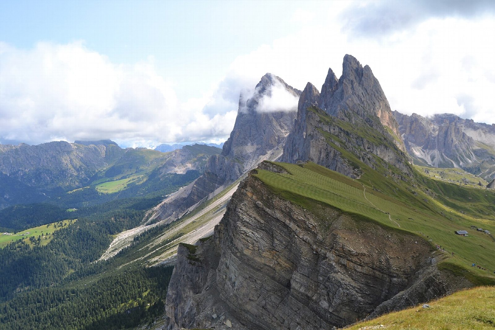
The walk starts at the top station of the Col Raiser gondola, above Santa Cristina in Val Gardena. Forest road 2 leads west across the pastures, and path 1A climbs steadily to the summit cross of Seceda, 2,519 m, where the grass ends in cliffs above the Odle (Geisler) needles and the Val di Funes. The way down follows path 1 east under the Fermeda, past the Troier hut and the Pieralongia pastures, and back to Col Raiser.
It is 9.1 km round with 420 m of ascent; allow about 3½ hours. The grade is Moderate: good tracks and paths over open pasture, steepest on the climb to the summit.
The famous view along the ridge is a little beyond the summit cross, on path 6 towards the Forcella Pana. Since June 2026 the landowners have again charged €5 to walk that path. This walk turns at the summit cross and comes down by path 1, which is free. The north side of the ridge is a sheer drop: keep back from the edge. Snow can lie on the higher paths early and late in the season.
The Col Raiser gondola runs from 22 May to 1 November in 2026. Its valley station has car parks and a bus stop. Outside the lift season this walk means a climb of almost 1,000 m from the valley.
Route drawn by Global Adventurer along OpenStreetMap paths (© OpenStreetMap contributors, ODbL), with figures worked out from it. Check the forecast and the ground on the day: paths change.
Good to know
- Seceda, 2,519 m, ends in a grassy ridge that breaks off in cliffs above the Odle (Geisler) needles
- Odles is Ladin for needles; the name Seceda is said to come from the Latin siccus, dry
- In the Puez-Odle nature park, founded in 1978
- In 2026 the landowners again charged €5 on the path beyond the summit cross
Summits on the way
- Secëda - Monte Seceda 2,519 m · passed close by
Getting there
Start: Col Raiser gondola top station. 46.58478, 11.74532
Places to stay nearby
Rooms in and around Dolomites: Booking.com → Expedia →
Affiliate links: if you book, Global Adventurer earns a small commission at no cost to you.
Paths change, and the weather decides the day. The line and figures come from OpenStreetMap and our own checks; take a map, check the forecast, and turn back if it isn't right.
