Line © OpenStreetMap contributors (ODbL), checked by Global Adventurer.
The walk
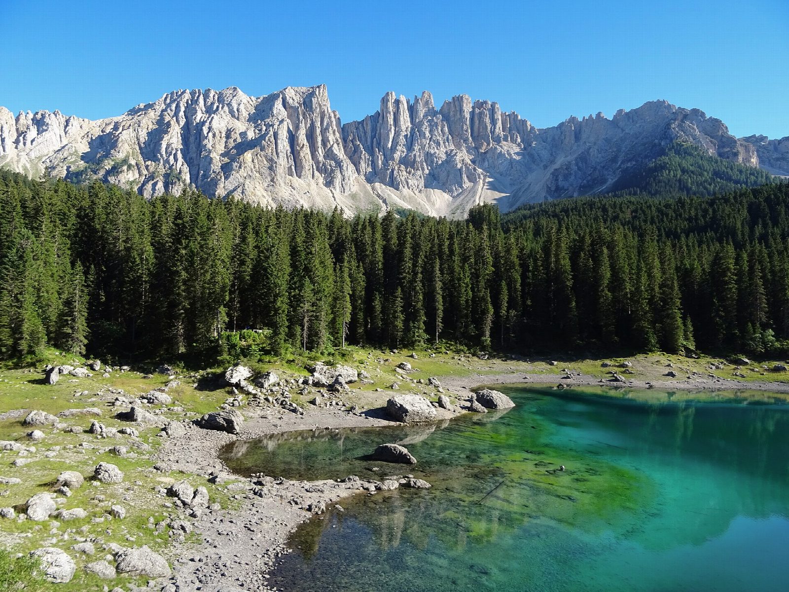
From the Paolina car park in Carezza, path 10 leads past the Grand Hotel Carezza and across the road, and path 12 goes south through the forest to the hollow of the Mittersee (Lago di Mezzo). The path turns west and then north to the shore of the Lago di Carezza (Karersee), with the Latemar rising beyond the water. A pedestrian underpass leads to the lake car park, and path 6 returns through the woods and the village to Paolina.
It is 5.3 km round with 113 m of ascent; allow about 1½ hours. The grade is Easy: forest paths, tracks and village lanes, with gentle climbs.
The Lago di Carezza lies at 1,520 m and is up to 22 m deep; its Ladin name means rainbow lake. It is a protected natural monument and is fenced, so it is seen from the path round it. The Mittersee fills with meltwater for only a few weeks in spring, around May and June, and is often dry. The tourist board gives May to November as the season for this walk.
There are three paid car parks at the lake, which cannot be booked; the visitor centre and underpass are open from 9:00 to 17:00. Several bus lines stop at Paolina, and the Carezza cable car ran until 1 November in 2026.
Route drawn by Global Adventurer along OpenStreetMap paths (© OpenStreetMap contributors, ODbL), with figures worked out from it. Check the forecast and the ground on the day: paths change.
Good to know
- Lago di Carezza (Karersee), at 1,520 m, reflects the Latemar; its Ladin name means rainbow lake
- The lake is a natural monument and is fenced; it is up to 22 m deep
- The Mittersee fills only for a few weeks in spring, around May and June
- Views of the Catinaccio (Rosengarten) and the Latemar
Getting there
Start: Paolina car park · Pay and display. 46.40690, 11.59048
Places to stay nearby
Rooms in and around Dolomites: Booking.com → Expedia →
Affiliate links: if you book, Global Adventurer earns a small commission at no cost to you.
Paths change, and the weather decides the day. The line and figures come from OpenStreetMap and our own checks; take a map, check the forecast, and turn back if it isn't right.
