Line © OpenStreetMap contributors (ODbL), checked by Global Adventurer.
The hike
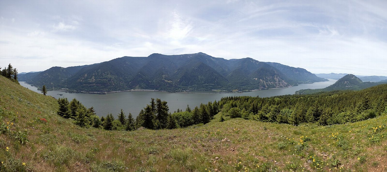
The walk starts at the Dog Mountain Trailhead on State Route 14 at milepost 53, east of Stevenson. The trail climbs steeply through woods for 0.7 miles to a junction where two ways up divide, one harder and one easier; our line takes the shorter. They meet again below the open meadows, and the trail climbs on, past the site of a fire lookout built in 1931, to the summit at 2,948 feet. The view takes in the Columbia River and Mount Hood. Return the same way, or come down by the longer Augspurger Mountain Trail, which is easier on the knees.
It is 5.6 miles (9 km) round trip with 2,770 feet (845 m) of climbing; allow about 5½ hours. The grade is Hard: nearly 2,800 feet of climbing in under three miles.
On Saturdays and Sundays in the spring flower season, and on Memorial Day, each vehicle needs a permit booked on Recreation.gov, or you can ride the free shuttle from the Skamania County Fairgrounds. In 2026 the dates were April 11 to June 7. A $5 recreation fee or a Northwest Forest Pass is needed to park all year.
Stay on the trail to keep clear of poison oak, watch for loose rock on the way down, and expect strong wind in the summit meadows. Parking is limited, so go early or on a weekday.
Route drawn by Global Adventurer along OpenStreetMap paths (© OpenStreetMap contributors, ODbL), with figures worked out from it. Check the forecast and the ground on the day: paths change.
Good to know
- A relentless climb to meadows yellow with balsamroot in May, high above the Columbia
- Weekend vehicle permits are needed April to early June, or take the free shuttle from Stevenson
- Northwest Forest Pass needed; poison oak beside the trail and strong wind on top
Summits on the way
- Dog Mountain 2,946 ft (898 m)
Getting there
Start: Dog Mountain Trailhead · Parking fee. 45.69924, -121.70881
Places to stay nearby
Rooms in and around Columbia River Gorge: Booking.com → Expedia →
Affiliate links: if you book, Global Adventurer earns a small commission at no cost to you.
Paths change, and the weather decides the day. The line and figures come from OpenStreetMap and our own checks; take a map, check the forecast, and turn back if it isn't right.