Line © OpenStreetMap contributors (ODbL), checked by Global Adventurer.
The hike
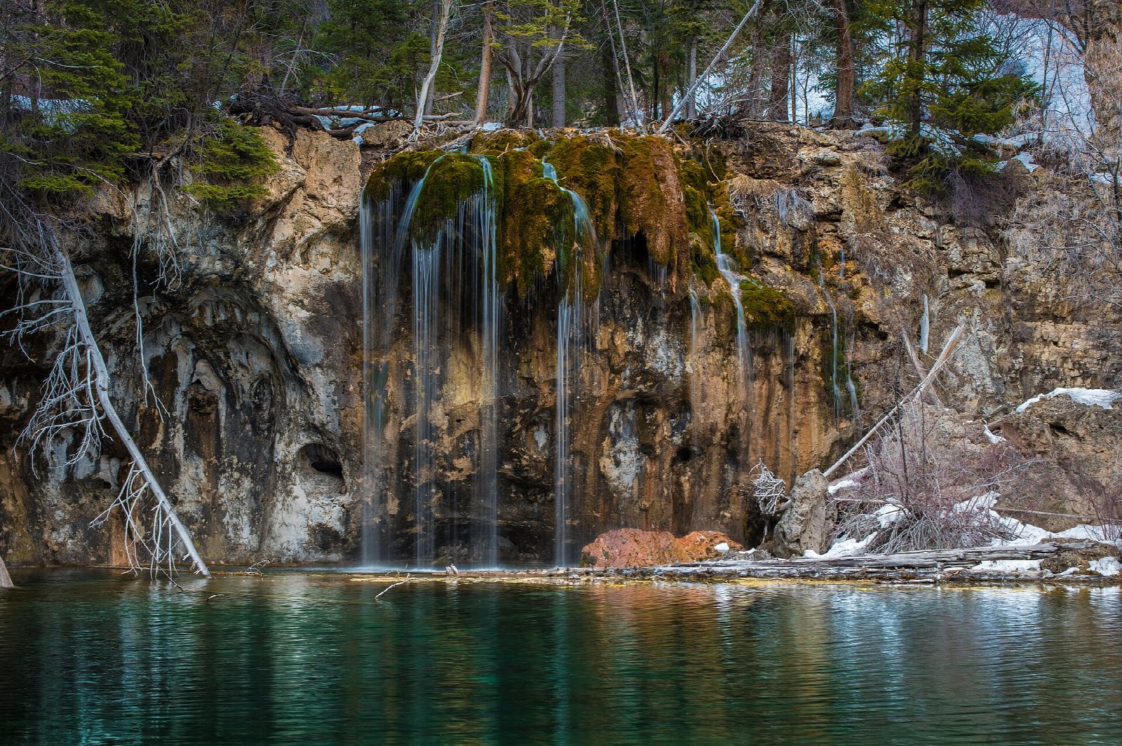
The walk starts at the Hanging Lake Rest Area in Glenwood Canyon, at exit 125 of Interstate 70. Follow the paved Glenwood Canyon path beside the Colorado River for half a mile to the trailhead. The Hanging Lake Trail, rebuilt after the debris flows of 2021, climbs the narrow canyon of Dead Horse Creek, steep and rocky, over seven bridges to a last rock staircase with handrails. A boardwalk runs along the edge of Hanging Lake, below Bridal Veil Falls. A short side trail climbs on to Spouting Rock, where a waterfall bursts from the cliff above the lake. Return the same way.
It is 3.3 miles (5.3 km) round trip with 1,410 feet (430 m) of climbing; allow about 3 hours. The grade is Moderate: short, but steep and rocky, climbing about 1,200 feet in little more than a mile.
Every visitor needs a timed permit all year, booked ahead with Visit Glenwood Springs; it costs $12 a person in summer and includes parking. Arrive within 30 minutes of your time. There is no exit for westbound traffic.
Dogs are not allowed. Do not swim, wade or touch the water. There is no water, no toilet and no phone signal on the trail. After heavy rain the trail and the interstate may be closed, and in winter the trail is icy: take traction devices.
Route drawn by Global Adventurer along OpenStreetMap paths (© OpenStreetMap contributors, ODbL), with figures worked out from it. Check the forecast and the ground on the day: paths change.
Good to know
- A permit, booked ahead online, is needed to hike here every day of the year
- A clear lake on a travertine ledge, fed by waterfalls; a National Natural Landmark
- Steep and rocky up Dead Horse Canyon; no dogs, and no swimming or touching the water
Getting there
Start: Hanging Lake Rest Area. 39.58912, -107.19055
Places to stay nearby
Rooms in and around Colorado Rockies: Booking.com → Expedia →
Affiliate links: if you book, Global Adventurer earns a small commission at no cost to you.
Paths change, and the weather decides the day. The line and figures come from OpenStreetMap and our own checks; take a map, check the forecast, and turn back if it isn't right.