Line © OpenStreetMap contributors (ODbL), checked by Global Adventurer.
The walk
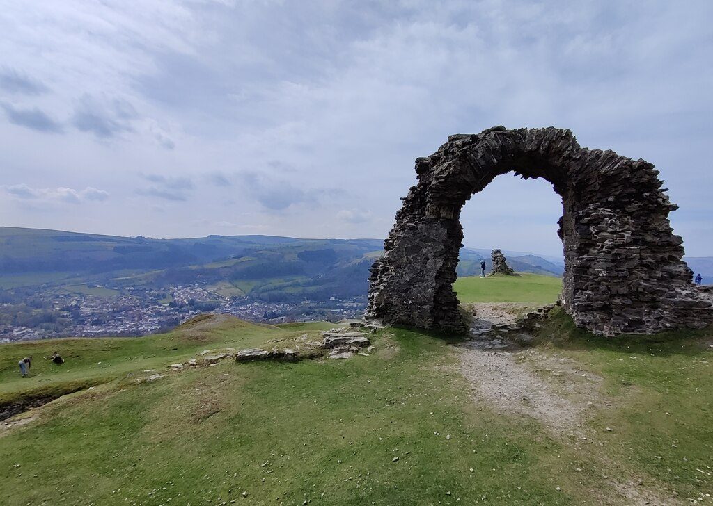
The walk starts from the Market Street car park in Llangollen. Cross Llangollen Bridge over the Dee, go up to the canal wharf and follow the towpath east for about 2 km. At Llandyn leave the canal and climb by lanes and field paths past Llandyn Hall, then steeply up the east side of the hill to the ruins of Castell Dinas Brân at 320 m. The castle stands inside the bank and ditch of a much older hillfort. Leave by the zigzag path down the west side and follow the signed path and lane back down to the canal, the bridge and the town.
It is 6.9 km with 242 m of ascent; allow about 2½ hours. The grade is Easy, but the last climb to the castle is steep.
The paths on the hill are steep and can be slippery when wet. There are no facilities at the castle, which is open all year. The hill is grazed by sheep: on open access land dogs must be on a short lead from 1 March to 31 July, and near livestock at any time.
The car park is pay and display, and the town has cafés, pubs and toilets. Buses, including the T3 between Wrexham and Barmouth, stop in Llangollen.
Route drawn by Global Adventurer along OpenStreetMap paths (© OpenStreetMap contributors, ODbL), with figures worked out from it. Check the forecast and the ground on the day: paths change.
Good to know
- The ruined castle was probably built in the 1260s by Gruffydd Maelor II, prince of Powys Fadog
- In 1277 its Welsh garrison burned it rather than let the English take it
- It stands inside an Iron Age hillfort
- The name is usually taken to mean the crow's fortress
Summits on the way
- Castell Dinas Bran 321 m · passed close by
Getting there
Start: Market Street car park, Llangollen · Pay and display. 52.96902, -3.17263
Places to stay nearby
Rooms in and around Market Street car park: Booking.com → Expedia →
Affiliate links: if you book, Global Adventurer earns a small commission at no cost to you.
Paths change, and the weather decides the day. The line and figures come from OpenStreetMap and our own checks; take a map, check the forecast, and turn back if it isn't right.