Line © OpenStreetMap contributors (ODbL), checked by Global Adventurer.
The walk
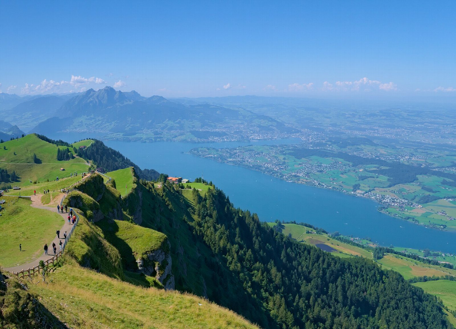
From Rigi Kulm, the summit station at 1,797 m, the path drops past Rigi Staffel to Rigi Kaltbad. There it joins the bed of the railway that ran from Kaltbad to Scheidegg until 1931, a broad and nearly level path. It curves round to Rigi First and then along the rock path cut into the cliff, with Lake Lucerne and the Alps spread out below. Past the inn at Unterstetten it continues to Rigi Scheidegg, at the end of the ridge.
It is 9 km one way with 344 m of ascent and 450 m of descent; allow about 3½ hours. The grade is Moderate: a steady descent at the start, then an easy old railway bed with a few short climbs.
The Rigi is busy on fine days, especially near the summit. Benches and inns line the way, and the path is busiest around Kaltbad and the summit.
Rack railways from Vitznau, which has boats from Lucerne, and from Arth-Goldau climb to Rigi Kulm. From Rigi Scheidegg a cable car runs down to Kräbel, a stop on the Arth-Goldau line.
Route drawn by Global Adventurer along OpenStreetMap paths (© OpenStreetMap contributors, ODbL), with figures worked out from it. Check the forecast and the ground on the day: paths change.
Good to know
- From the top of the Rigi, 1,797 m, down to Rigi Kaltbad, then along the bed of the railway from Kaltbad to Scheidegg, closed in 1931
- The rock path beyond Rigi First is cut into the cliff, high above Lake Lucerne
- Rack railways from Vitznau and Arth-Goldau run to Rigi Kulm; a cable car runs down from Rigi Scheidegg to Kräbel, on the Arth-Goldau line
Summits on the way
- Rigi Rotstock 1,650 m · passed close by
- Dossen 1,685 m · passed close by
Getting there
Start: Rigi Kulm station. 47.05515, 8.48387
By train: Rigi Staffel station is 0.8 km from the start.
Places to stay nearby
Rooms in and around Rigi Staffel: Booking.com → Expedia →
Affiliate links: if you book, Global Adventurer earns a small commission at no cost to you.
Paths change, and the weather decides the day. The line and figures come from OpenStreetMap and our own checks; take a map, check the forecast, and turn back if it isn't right.