Line © OpenStreetMap contributors (ODbL), checked by Global Adventurer.
The walk
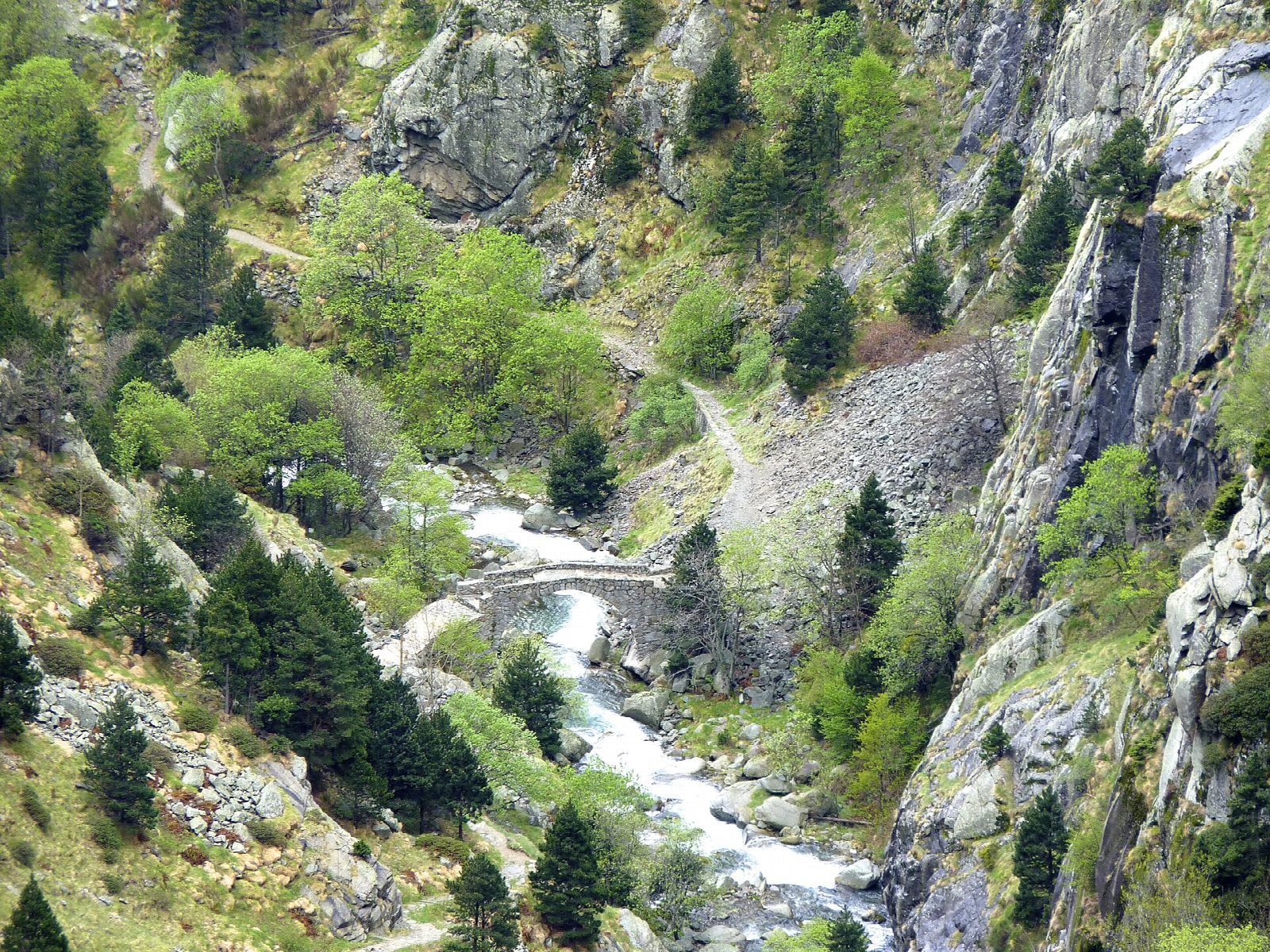
The walk starts at Queralbs station on the Núria rack railway, where there is free parking. The old path climbs through the woods above the village and into the gorge of the Riu de Núria, across the scree of the Tartera del Corbell and past the rock shelter of Sant Pau. It crosses the river at the Pont del Cremal and zigzags up beside the Salt del Sastre to the Cua de Cavall waterfall, then crosses back and climbs through pines to the cross at Creu d'en Riba, the high point, where the valley of Núria opens below. A short descent leads to the sanctuary.
It is 7.8 km one way with 894 m of climbing; allow about 4 hours. The grade is Moderate: a well-made path, but steep, stony and stepped through the gorge.
No road reaches Núria. The usual way back is the rack railway to Queralbs: an adult single cost €21.50 in 2026 and it is wise to book ahead. Check that the railway is running before you set out; if it is not, you must walk back down the same path.
There are two springs on the way, but carry water. In winter the path can need crampons or snowshoes.
Route drawn by Global Adventurer along OpenStreetMap paths (© OpenStreetMap contributors, ODbL), with figures worked out from it. Check the forecast and the ground on the day: paths change.
Good to know
- The old pilgrims' path up the gorge of the Riu de Núria, in and out of sight of the rack railway
- No road reaches Núria: come back down by the rack railway, which is ticketed, or on foot
- Past the Salt del Sastre and the Cua de Cavall waterfall to the cross at Creu d'en Riba
- In winter the path can need crampons or snowshoes
Getting there
Start: Queralbs rack railway station · Free parking. 42.35201, 2.16680
By train: Queralbs station is 0.1 km from the start.
Places to stay nearby
Rooms in and around Queralbs: Booking.com → Expedia →
Affiliate links: if you book, Global Adventurer earns a small commission at no cost to you.
Paths change, and the weather decides the day. The line and figures come from OpenStreetMap and our own checks; take a map, check the forecast, and turn back if it isn't right.