Line © OpenStreetMap contributors (ODbL), checked by Global Adventurer.
The walk
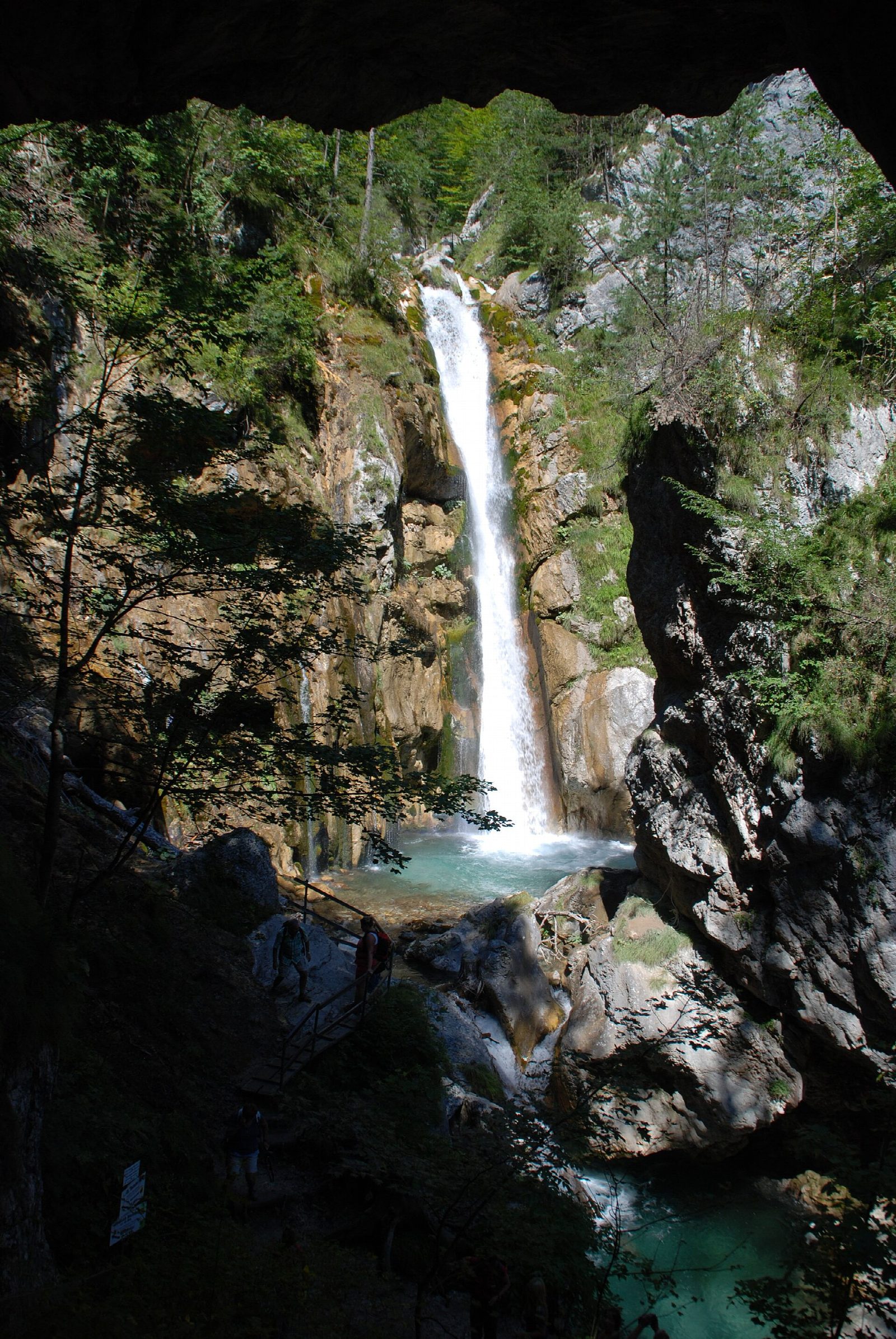
From the car park at Unterloibl, south of Ferlach, the path enters the Tscheppaschlucht beside the Loiblbach. Walkways, bridges and steps lead up through the narrow gorge, with rock walls up to about 60 m high and the stream racing below. Further up the Tschaukofall drops 26 m beside a natural rock gateway, and the Teufelsbrücke (Devil's Bridge), a suspension bridge, crosses the gorge. The path climbs on to the inn at Deutscher Peter, at the top of the gorge, where the walk ends.
It is 5 km one way with 230 m of ascent and 140 m of descent; allow about 2 hours. The grade is Easy: built walkways, metal gratings and more than 300 steps, steep and narrow in places.
The gorge is open daily from 1 May to 31 October, 8:30 to 17:00, and may be closed for safety in bad weather. Entry and parking are charged, and the entry fee includes the bus from Deutscher Peter back to the car park. Sturdy shoes are needed; the gorge is not suitable for pushchairs or children under four. Dogs are allowed.
Unterloibl is on the Loibl pass road south of Ferlach, which has buses from Klagenfurt. There is a bus stop by the car park.
Route drawn by Global Adventurer along OpenStreetMap paths (© OpenStreetMap contributors, ODbL), with figures worked out from it. Check the forecast and the ground on the day: paths change.
Good to know
- A gorge of the Loiblbach in the Karawanken, about 4.4 km long, with walkways, bridges and more than 300 steps
- The 26 m Tschaukofall, a natural rock gateway and the Teufelsbrücke (Devil's Bridge), a suspension bridge, are the highlights
- Open daily from 1 May to 31 October, 8:30 to 17:00; a bus back to the start is included in the entry fee
Getting there
Start: Unterloibl, Tscheppaschlucht car park · Pay and display. 46.49745, 14.28395
Places to stay nearby
Rooms in and around Unterloibl: Booking.com → Expedia →
Affiliate links: if you book, Global Adventurer earns a small commission at no cost to you.
Paths change, and the weather decides the day. The line and figures come from OpenStreetMap and our own checks; take a map, check the forecast, and turn back if it isn't right.