Line © OpenStreetMap contributors (ODbL), checked by Global Adventurer.
The hike
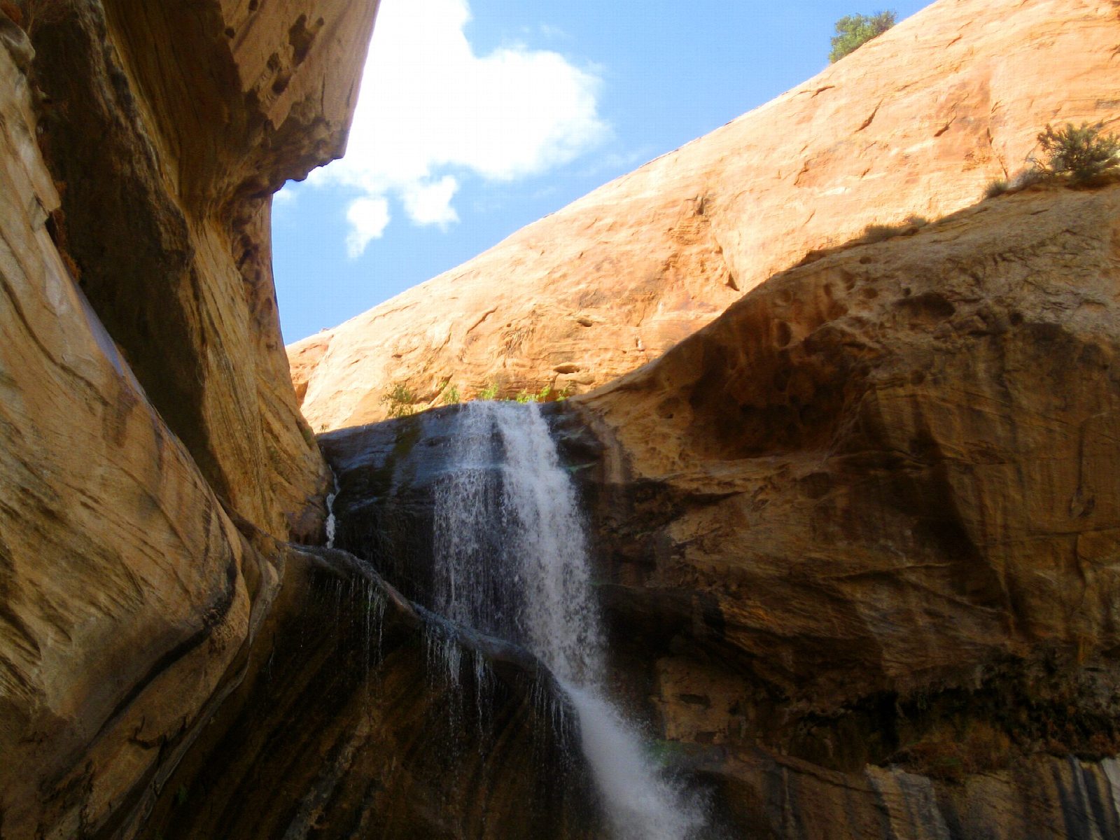
The trail starts in the Calf Creek Recreation Area, off Highway 12 between Escalante and Boulder, 15 miles east of Escalante. From the day-use car park walk up through the campground to the trailhead. The path follows the creek upstream over stretches of deep sand, with 15 numbered posts along the way: granaries and painted figures can be picked out on the far wall of the canyon, and beaver ponds in the creek. The canyon ends at the falls, which drop 126 feet into a shaded pool. Return the same way.
It is 6.1 miles (9.8 km) round trip with 660 feet (202 m) of climbing; allow about 3 hours. The grade is Easy: there is little climbing, but the sand makes it slow and tiring, and the Bureau of Land Management calls it moderately difficult.
The Bureau charges $5 a vehicle for day use. The hike is hot in summer, with little shade before the falls: carry plenty of water, and do not drink from the creek. Dogs are allowed, on a lead. There are restrooms at the trailhead. The site was closed for rebuilding in the summer of 2024, and more work was planned for 2025 and 2026: check with the Escalante Interagency Visitor Center that it is open before a long drive.
Route drawn by Global Adventurer along OpenStreetMap paths (© OpenStreetMap contributors, ODbL), with figures worked out from it. Check the forecast and the ground on the day: paths change.
Good to know
- A waterfall about 38 m high pours into a green pool at the head of a sandstone canyon
- Fremont rock art and a granary can be spotted high on the canyon walls
- Deep sand in places and little shade; the BLM charges a day-use fee at Calf Creek
Getting there
Start: Lower Calf Creek Falls Trailhead. 37.79368, -111.41503
Places to stay nearby
Rooms in and around Capitol Reef and Grand Staircase–Escalante: Booking.com → Expedia →
Affiliate links: if you book, Global Adventurer earns a small commission at no cost to you.
Paths change, and the weather decides the day. The line and figures come from OpenStreetMap and our own checks; take a map, check the forecast, and turn back if it isn't right.