Line © OpenStreetMap contributors (ODbL), checked by Global Adventurer.
The walk
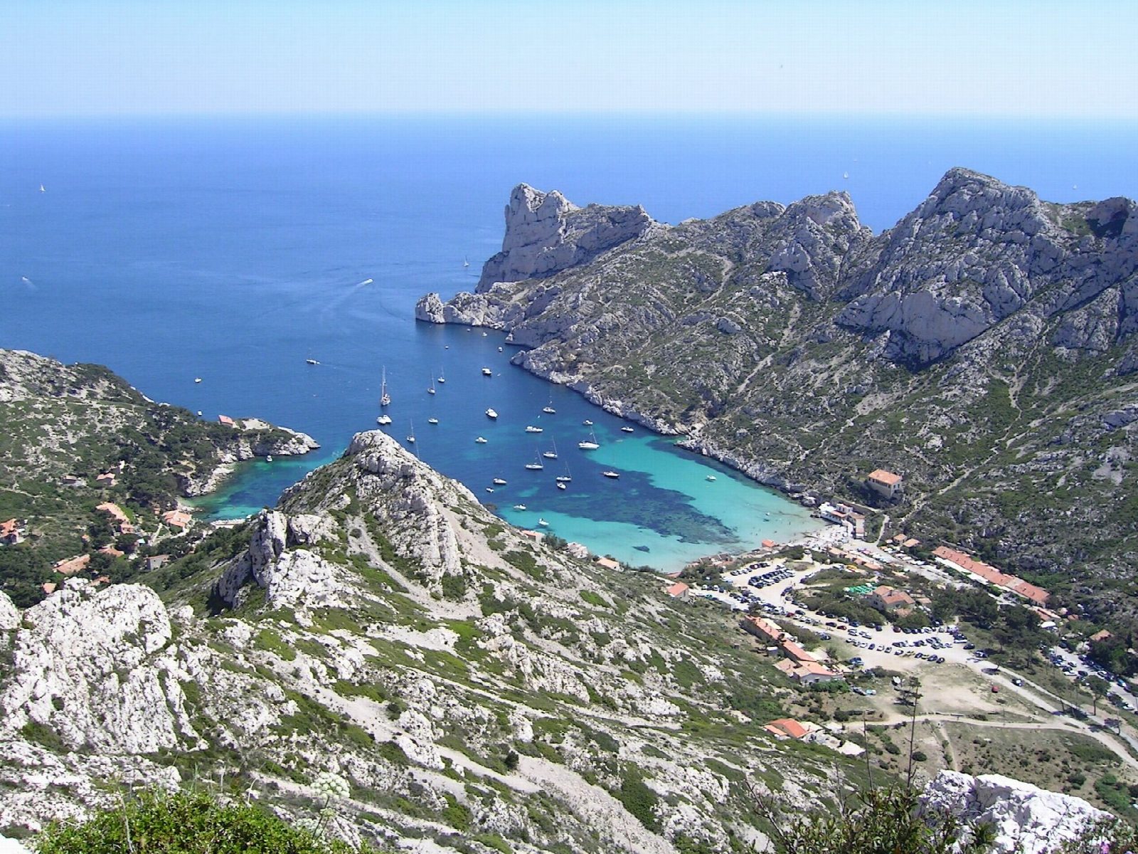
From the car park at the Col de Sormiou, where a barrier closes the road to traffic, a path drops south-east across the hillside to the Calanque de Sormiou, with its beach, fishermen's huts and white limestone walls. A path climbs east from the calanque over the ridge between the two inlets and drops to the little harbour of Morgiou, crowded with boat huts. From Morgiou the way back climbs north up the valley to the Col de Morgiou and returns west along the slope to the Col de Sormiou.
It is 8.6 km round with 479 m of ascent; allow about 3½ hours. The grade is Moderate: stony limestone paths with short steep climbs and descents.
The limestone is rough and in places polished, there is little shade, and there is no drinking water on the hills, so carry plenty in warm weather. From 1 June to 30 September access to the massif is set each day by the prefecture according to the fire risk; on a red day the Parc national des Calanques is closed to walkers. Check the level, published between 5 and 6 pm for the next day, on the Mes Calanques app or the prefecture's site.
The roads to Sormiou and Morgiou are closed to cars beyond their barriers, and parking at the col is limited. City buses run to the Baumettes and Luminy area.
Route drawn by Global Adventurer along OpenStreetMap paths (© OpenStreetMap contributors, ODbL), with figures worked out from it. Check the forecast and the ground on the day: paths change.
Good to know
- Sormiou and Morgiou are the two largest calanques on the Marseille side of the Parc national des Calanques, each with a cluster of fishermen's huts
- The loop goes down the road to Sormiou, over the ridge to Morgiou and back over the Col de Morgiou
- From 1 June to 30 September access to the massif depends on the daily fire-risk level set by the prefecture
Summits on the way
- Canapé de Sormiou 239 m · passed close by
- Le Cancéou 219 m · passed close by
- Aiguille du Sorbet · passed close by
Getting there
Start: Col de Sormiou car park. 43.21649, 5.40879
Places to stay nearby
Rooms in and around Marseille-Blancarde: Booking.com → Expedia →
Affiliate links: if you book, Global Adventurer earns a small commission at no cost to you.
Paths change, and the weather decides the day. The line and figures come from OpenStreetMap and our own checks; take a map, check the forecast, and turn back if it isn't right.
