Line © OpenStreetMap contributors (ODbL), checked by Global Adventurer.
The walk
The walk starts from the Loch Morlich beach car park at the east end of the loch; all the car parks along the loch charge. It follows the red waymarkers round the loch: through the pines past the toilets, over the Abhainn Ruigh-eunachan by a footbridge and west along the south shore, then round the far end on forest tracks to a green bridge by the road. The way back is along the north shore, between the road and the water, past a string of small sandy beaches.
It is 5.5 km (3.4 miles) and almost level, with about 12 m (40 ft) of ascent; allow about 1½ hours. The grade is Easy.
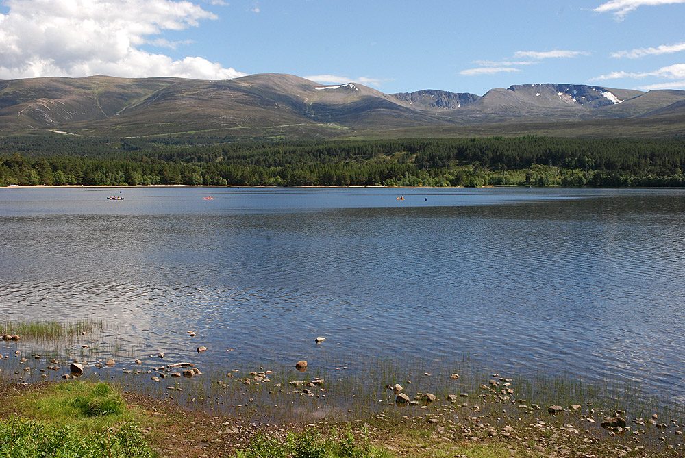
From the south shore Meall a' Bhuachaille is often mirrored in the water, and there are views across the loch to the Monadh Liath. From the beach near the sailing club comes the classic view south over the loch to Cairn Gorm and Braeriach.
The paths and tracks are good all the way, and there are plenty of places to get down to the water. The last part is close to the road, and the beaches are busy on summer days. The Glenmore bus from Aviemore stops near the start.
Route drawn by Global Adventurer along OpenStreetMap paths (© OpenStreetMap contributors, ODbL), with figures worked out from it. Check the forecast and the ground on the day: paths change.
Good to know
- Round the loch through Glenmore Forest on paths and tracks marked with red posts
- Sandy beaches on the north shore, with views across the water to Cairn Gorm and Braeriach
- Meall a' Bhuachaille is often mirrored in the loch from the south shore
Getting there
Start: Loch Morlich beach car park · Pay and display. 57.16774, -3.70021
Places to stay nearby
Rooms in and around Aviemore: Booking.com → Expedia →
Affiliate links: if you book, Global Adventurer earns a small commission at no cost to you.
Paths change, and the weather decides the day. The line and figures come from OpenStreetMap and our own checks; take a map, check the forecast, and turn back if it isn't right.


