Line © OpenStreetMap contributors (ODbL), checked by Global Adventurer.
The walk
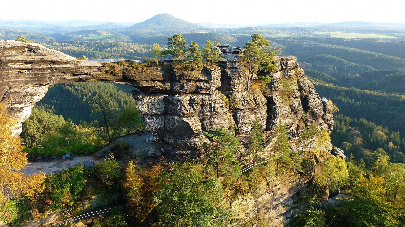
From the car park in Hřensko, walk east along the valley road to Tři prameny, then take the path that climbs steadily up a wooded ravine between sandstone walls to Pravčická brána. The great arch stands beside the Sokolí hnízdo, the Falcon's Nest, built as a hotel in 1881, and paths on the rocks nearby look across the arch and the forests of Bohemian Switzerland. Return the same way.
It is 9.5 km there and back with 292 m of ascent; allow about 3 hours. The grade is Moderate: a lane along the valley, then a steady climb on a good path with steps.
The area round the arch is private and charges admission: adults 125 CZK (€5) in 2026, daily 10:00 to 18:00 until the end of October, then on Fridays and weekends 10:00 to 16:00. Walking on the arch itself is forbidden. Since the forest fire of 2022 the national park warns of falling trees everywhere and allows visits only on marked paths, between 6:00 and 22:00.
Hřensko has pay car parks, which fill early on summer weekends.
Route drawn by Global Adventurer along OpenStreetMap paths (© OpenStreetMap contributors, ODbL), with figures worked out from it. Check the forecast and the ground on the day: paths change.
Good to know
- Pravčická brána is the largest natural sandstone arch in Europe
- Walking on top of the arch has long been forbidden, as the rock has grown more fragile
- The Sokolí hnízdo (Falcon's Nest) beside the arch was built as a hotel in 1881
- A forest fire in 2022 burned a large part of the national park around the arch
Summits on the way
- Hraniční kámen · passed close by
- Zelenáč · passed close by
- Malý Pravčický kužel · passed close by
- Křížová věž · passed close by
Getting there
Start: Hřensko, village car park · Pay and display. 50.87440, 14.24378
Places to stay nearby
Rooms in and around Hřensko: Booking.com → Expedia →
Affiliate links: if you book, Global Adventurer earns a small commission at no cost to you.
Paths change, and the weather decides the day. The line and figures come from OpenStreetMap and our own checks; take a map, check the forecast, and turn back if it isn't right.