Line © OpenStreetMap contributors (ODbL), checked by Global Adventurer.
The hike
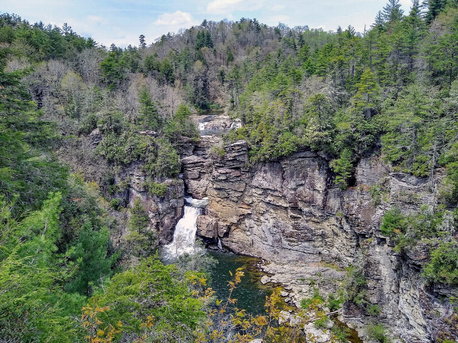
The walk starts at the Linville Falls parking area, at the end of the spur road that leaves the Blue Ridge Parkway at milepost 316.4. The visitor center that stood here was destroyed by Hurricane Helene; the trails start from its site. Cross the Linville River on the footbridge and follow the Erwins View Trail. A side path at half a mile leads down to the first overlook, beside the upper falls. The trail then climbs steeply to Chimney View, the first place from which the lower falls can be seen, and on to Gorge View and Erwins View, which looks down the gorge and back to the falls. Return the same way.
It is 2.2 miles (3.6 km) round trip with 450 feet (138 m) of climbing; allow about 1½ hours. The grade is Easy: a broad path, moderate at first and steep in its upper half.
Swimming in the river and climbing on the rocks are dangerous and are not allowed: people have died at these falls. Keep to the overlooks.
The Parkway is still closed south of Linville Falls, so come from the north or by US 221. There is no entrance fee, and there are portable toilets only. On the other side of the river the trail down to the foot of the falls remains closed; the Plunge Basin overlook is open.
Route drawn by Global Adventurer along OpenStreetMap paths (© OpenStreetMap contributors, ODbL), with figures worked out from it. Check the forecast and the ground on the day: paths change.
Good to know
- Overlooks of the upper and lower falls where the Linville River drops into its gorge
- Easy walking to four viewpoints, the farthest looking down Linville Gorge
- Hurricane Helene closed some trails here: check the Parkway's updates before you go
Getting there
Start: Linville Falls parking area (Blue Ridge Parkway mile 316.4). 35.95545, -81.92812
Places to stay nearby
Rooms in and around Blue Ridge Mountains: Booking.com → Expedia →
Affiliate links: if you book, Global Adventurer earns a small commission at no cost to you.
Paths change, and the weather decides the day. The line and figures come from OpenStreetMap and our own checks; take a map, check the forecast, and turn back if it isn't right.