Line © OpenStreetMap contributors (ODbL), checked by Global Adventurer.
The walk
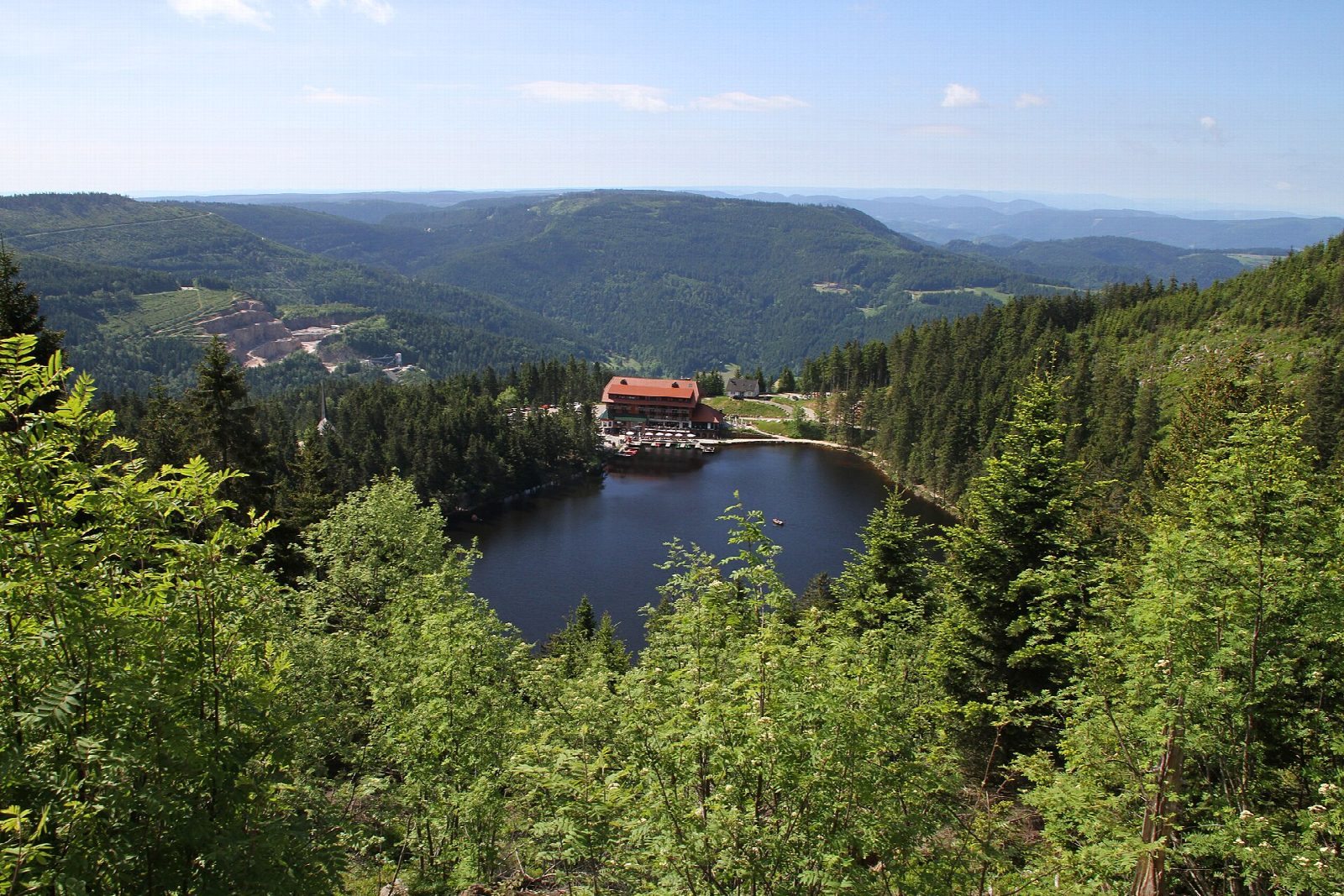
The walk starts from the walkers' car park at Seibelseckle, a pass on the Black Forest High Road. A path leads west to the Mummelsee, a dark tarn in a cirque, and along its shore past the hotel. From the lake it climbs round the flank of the Katzenkopf to the Hornisgrinde tower at the south end of the summit plateau, follows the west side north to the Bismarck tower on the highest point, 1,164 m, and comes back on the boardwalk across the raised bog to the Dreifürstenstein, a rock slab that marked the border of Baden, Württemberg and the bishopric of Strasbourg in 1722. A steep, narrow path then drops through the wood to Seibelseckle.
It is 5.9 km with 231 m of ascent; allow about 2 hours. The grade is Easy, though the last descent is steep and rough.
The plateau is open, exposed and often windy. The bog is up to 5 m deep and at least 6,000 years old: stay on the boardwalk. The summit was a closed military zone until 1997, and its road is still closed to cars. The Bismarck tower can be climbed free by its outside stair.
The walk is best from May to October; in winter the paths are under snow. Buses from Achern stop at Seibelseckle and the Mummelsee, but line numbers differ between sources, so check a timetable.
Route drawn by Global Adventurer along OpenStreetMap paths (© OpenStreetMap contributors, ODbL), with figures worked out from it. Check the forecast and the ground on the day: paths change.
Good to know
- The Hornisgrinde, 1,164 m, is the highest point of the northern Black Forest
- A boardwalk crosses the raised bog on the treeless summit plateau
- The Bismarck tower of 1871 marks the top; the Dreifürstenstein is a rock slab marking the border of 1722 between Baden, Württemberg and the bishopric of Strasbourg
- The Mummelsee is a dark tarn in the cirque below, on the Black Forest High Road
- The way down from the Dreifürstenstein to Seibelseckle is steep and narrow
Summits on the way
- Hornisgrinde 1,164 m
Getting there
Start: Seibelseckle walkers' car park. 48.59602, 8.21798
Places to stay nearby
Rooms in and around Black Forest: Booking.com → Expedia →
Affiliate links: if you book, Global Adventurer earns a small commission at no cost to you.
Paths change, and the weather decides the day. The line and figures come from OpenStreetMap and our own checks; take a map, check the forecast, and turn back if it isn't right.
