Line © OpenStreetMap contributors (ODbL), checked by Global Adventurer.
The hike
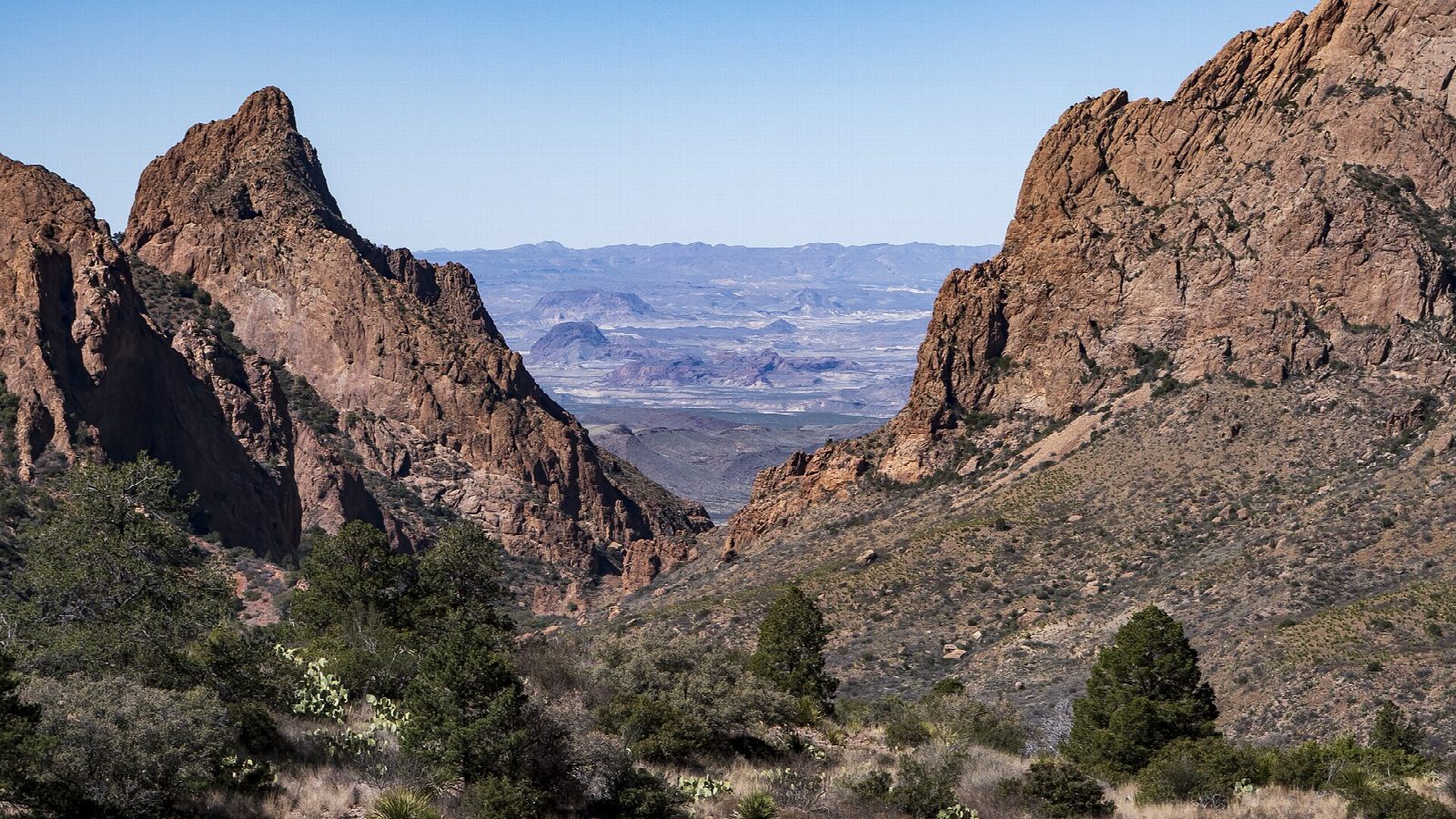
The walk starts at the Chisos Basin Trailhead, on the paved walkway near the Basin store and the visitor center parking lot. The Window Trail drops west across open slopes below the Basin campground, where a shorter version of the walk joins it, and then follows Oak Creek down its canyon. The creek may be flowing and is crossed several times. The last quarter mile runs through a narrow canyon of smooth rock, where the footing is awkward, to the Window: the notch where the whole Basin drains over a high pour-off, with the desert framed beyond. Return the same way.
It is 5.5 miles (8.9 km) round trip with 1,020 feet (311 m) of climbing; allow about 3 hours. The grade is Moderate: downhill all the way out, so the 1,000-foot climb comes on the way back.
The top of the pour-off is slickrock with no railing: stay well back from the edge, above all when it is wet. The climb back often comes in the heat of the day, so start early and carry a litre of water for each hour.
The park charges $30 a vehicle, valid for seven days and paid by card. The two-year closure of the Chisos Basin that was planned from May 2026 has been cancelled. Starting from the Basin Campground trailhead cuts the walk to about four miles.
Route drawn by Global Adventurer along OpenStreetMap paths (© OpenStreetMap contributors, ODbL), with figures worked out from it. Check the forecast and the ground on the day: paths change.
Good to know
- Down Oak Creek Canyon to the Window, a narrow notch where the whole Basin drains out
- The pour-off at the end is slickrock with no railing above a long drop: stay well back
- Downhill all the way out, so the hot climb back comes last
Getting there
Start: Chisos Basin Trailhead. 29.27007, -103.30055
Places to stay nearby
Rooms in and around Big Bend: Booking.com → Expedia →
Affiliate links: if you book, Global Adventurer earns a small commission at no cost to you.
Paths change, and the weather decides the day. The line and figures come from OpenStreetMap and our own checks; take a map, check the forecast, and turn back if it isn't right.
