Line © OpenStreetMap contributors (ODbL), checked by Global Adventurer.
The walk
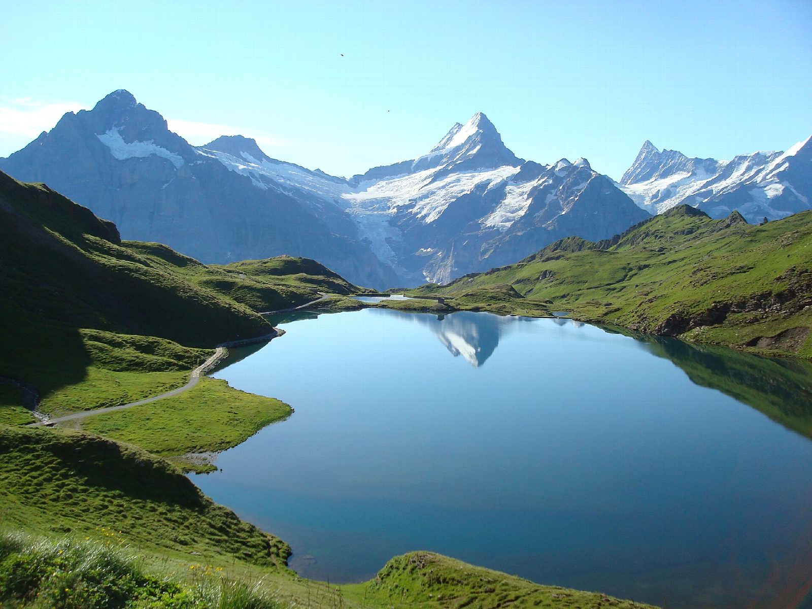
From the top station of the First gondola, above Grindelwald, a broad and well-made path heads west across the open alp. It climbs gently across the open alp and over a low rise, then drops slightly to the Bachalpsee, which lies in a hollow below the Faulhorn. On a still day the Schreckhorn, Wetterhorn and the other peaks across the valley are reflected in the water. Walk along the shore, then return the same way.
It is 6.6 km there and back with 195 m of ascent; allow about 2 hours. The grade is Easy: a wide gravel path with gentle slopes, though at well over 2,000 m.
This is one of the busiest paths in the Bernese Oberland on summer days, so go early for a quiet lake. The path is high and open: take warm clothes even in summer, and expect snow from late autumn to early summer, when the path may be used as a winter walk. Cows graze the alp in summer; keep dogs on a lead near them.
The First gondola leaves from the centre of Grindelwald, a short walk from the railway station. Check the timetable, as the lifts stop for maintenance in late autumn and spring.
Route drawn by Global Adventurer along OpenStreetMap paths (© OpenStreetMap contributors, ODbL), with figures worked out from it. Check the forecast and the ground on the day: paths change.
Good to know
- The Bachalpsee lies at about 2,265 m in a hollow above Grindelwald; on a still day the peaks across the valley are reflected in it
- A broad, well-made path of about 3 km each way from the First gondola, gently uphill on the way out
- The gondola from Grindelwald climbs to First at about 2,170 m; the Cliff Walk walkway hangs off the rock beside the top station
Getting there
Start: First, top station of the gondola from Grindelwald. 46.65964, 8.05358
Places to stay nearby
Rooms in and around First: Booking.com → Expedia →
Affiliate links: if you book, Global Adventurer earns a small commission at no cost to you.
Paths change, and the weather decides the day. The line and figures come from OpenStreetMap and our own checks; take a map, check the forecast, and turn back if it isn't right.