Line © OpenStreetMap contributors (ODbL), checked by Global Adventurer.
The walk
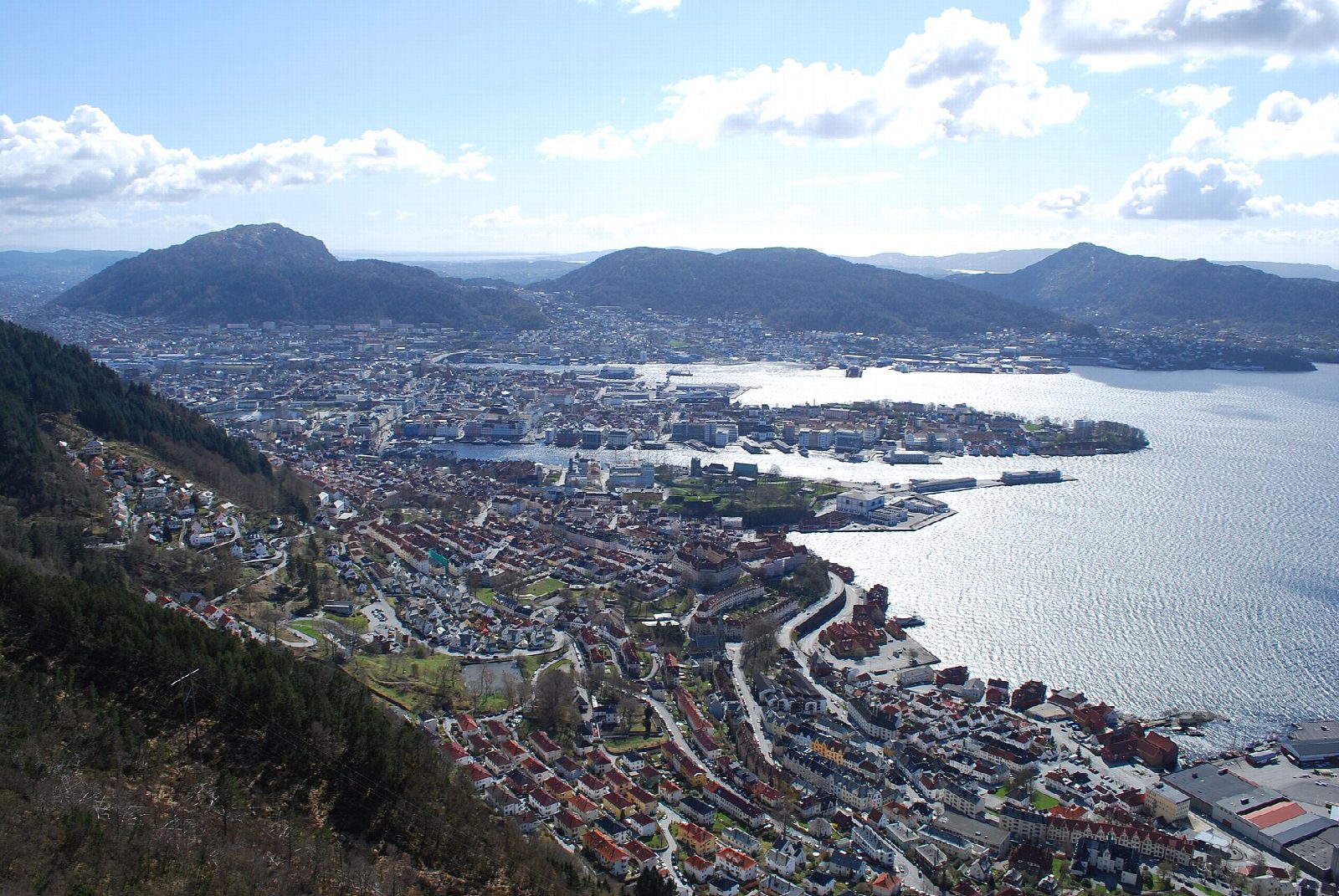
From the bus stop at Formanns vei in Sandviken, walk up to the foot of Stoltzekleiven, where stone steps climb a steep cleft in the hillside. At the top the path comes out on Sandviksfjellet, 417 m, with wide views over the city, the harbour and the islands to the west. A gravel road then runs south through the woods to Fløyen, from where the Fløibanen funicular runs down to Fisketorget, the fish market in the centre of Bergen.
It is 4.4 km with 414 m of ascent and 134 m of descent; allow about 2 hours. The grade is Easy by our reckoning of time, but the first part is steep and almost all steps.
Bergen og Hordaland Turlag gives the season as April to October. It describes the first part as mostly stone steps and steep climbing, and the second as an easy gravel road through woodland.
Buses run to Mulen and to Formanns vei, below the steps; there is no car park at the foot of the steps and only some parking at the roadside. You can also walk down from Fløyen into the city.
Route drawn by Global Adventurer along OpenStreetMap paths (© OpenStreetMap contributors, ODbL), with figures worked out from it. Check the forecast and the ground on the day: paths change.
Good to know
- Stone steps up the cleft of Stoltzekleiven to Sandviksfjellet, then a gravel road through the woods to Fløyen
- Buses run to Mulen and Formanns vei, below the steps
- The Fløibanen funicular runs down from Fløyen to the city centre
- The first part is mostly stone steps and steep climbing
Summits on the way
- Sandviksfjellet 417 m · passed close by
Getting there
Start: Formanns vei bus stop. 60.40967, 5.32641
Places to stay nearby
Rooms in and around Bergen: Booking.com → Expedia →
Affiliate links: if you book, Global Adventurer earns a small commission at no cost to you.
Paths change, and the weather decides the day. The line and figures come from OpenStreetMap and our own checks; take a map, check the forecast, and turn back if it isn't right.