Line © OpenStreetMap contributors (ODbL), checked by Global Adventurer.
The walk
From the car park at Inveraray Castle, take the lane from the far end, past the monument to seventeen Campbell leaders executed in 1685, and cross the ornate Frew's Bridge. Take the path that heads diagonally right into the woods, cross a track to another gate and follow the track beyond past the ruins of old lime kilns. Where the track levels off, a well-graded path forks right and climbs through the woods, past an old stone wall, to a saddle behind the summit, then zigzags up to the tower on the top. Return the same way.
It is 5.1 km with 229 m of ascent; allow about 2 hours. The grade is Easy: a good path, with one long, steep climb.
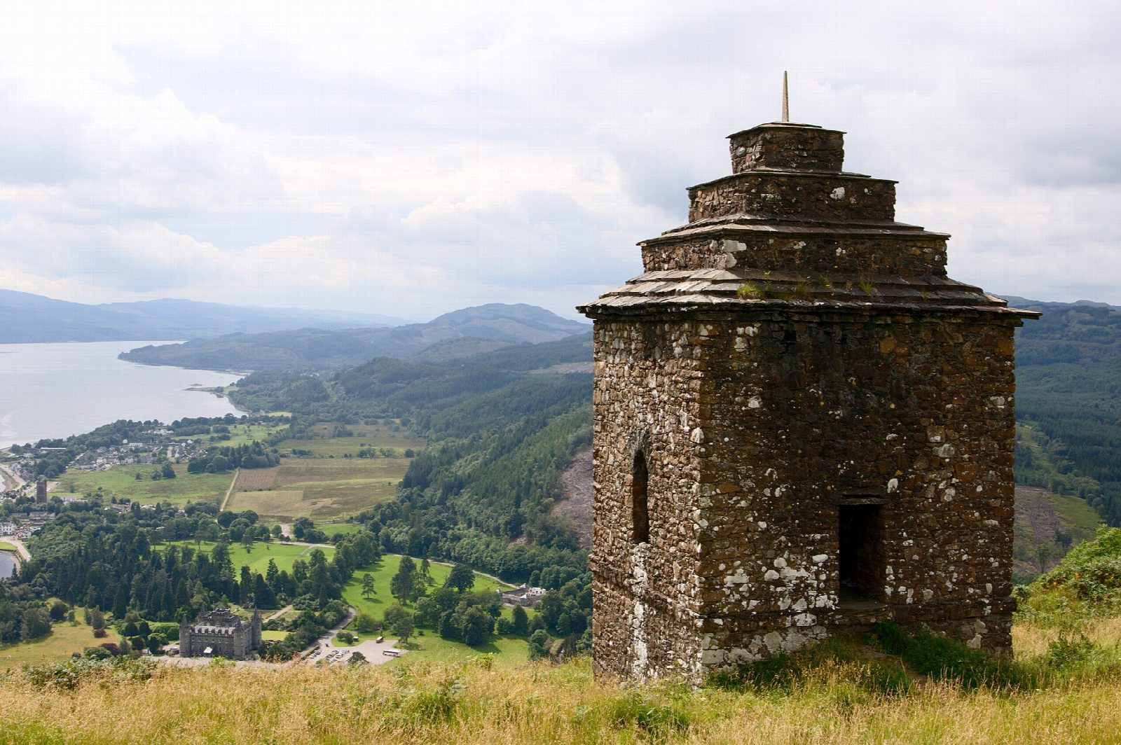
The tower stands next to where an Iron Age fort stood, close to a steep drop. Walkhighlands notes that the route is only partly waymarked and that the old circular descent is now closed. The woods are carpeted with bluebells in spring. The view takes in the castle, the town and Loch Fyne.
The castle car park charges. Buses to Inveraray stop a short walk away.
Route drawn by Global Adventurer along OpenStreetMap paths (© OpenStreetMap contributors, ODbL), with figures worked out from it. Check the forecast and the ground on the day: paths change.
Good to know
- A monument tower stands on top, beside the site of an Iron Age fort
- The path starts past a monument to seventeen Campbell leaders executed in 1685 and crosses Frew's Bridge
- The view takes in Inveraray Castle, the town and Loch Fyne
Getting there
Start: Inveraray Castle car park · Pay and display. 56.23821, -5.07470
Places to stay nearby
Rooms in and around Falls of Cruachan: Booking.com → Expedia →
Affiliate links: if you book, Global Adventurer earns a small commission at no cost to you.
Paths change, and the weather decides the day. The line and figures come from OpenStreetMap and our own checks; take a map, check the forecast, and turn back if it isn't right.