Line © OpenStreetMap contributors (ODbL), checked by Global Adventurer.
The hike
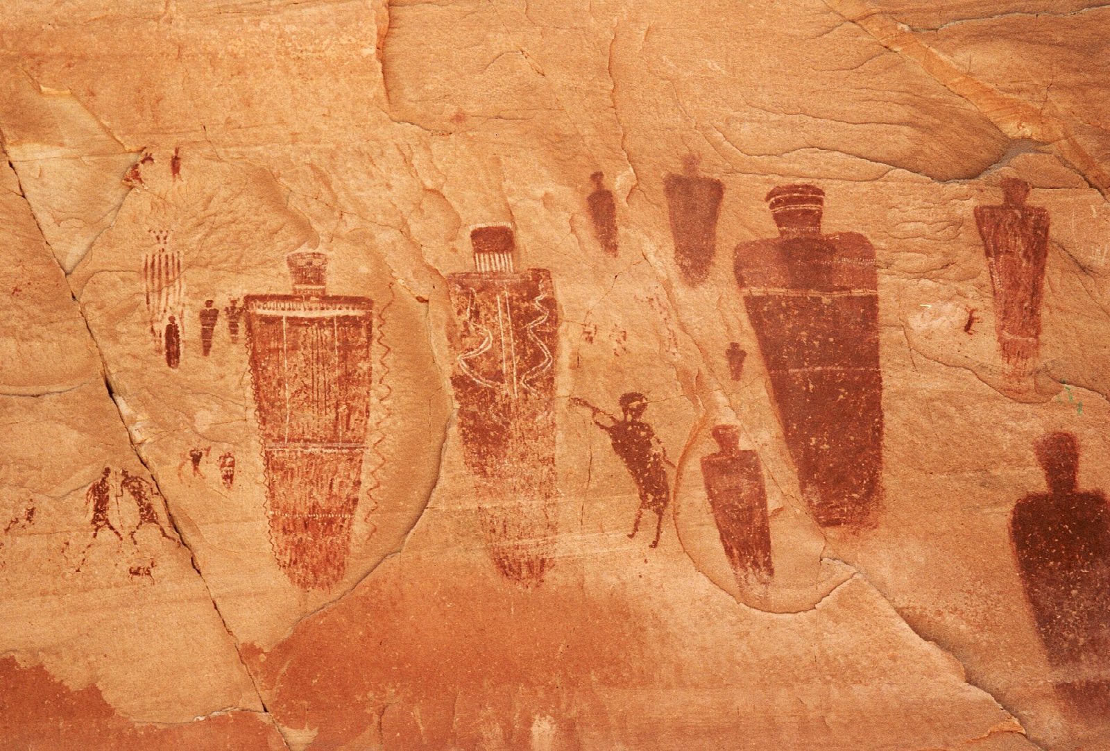
From the west rim trailhead an old stock trail drops steeply over slickrock, past water tanks left from ranching days, to the floor of Horseshoe Canyon. Turn up the canyon and walk along the sandy wash under the cottonwoods. The canyon holds four main panels of rock paintings; the last and largest is the Great Gallery, a long wall of tall, ghostly figures. Return the same way, saving strength for the climb out.
It is 7.3 miles (11.8 km) round trip with 1,070 feet (327 m) of climbing; allow about 4 hours. The grade is Moderate: the sand is slow going, and the climb of some 780 feet out of the canyon comes at the end. The park says to allow five hours or more.
This hike can be dangerously hot in summer: there is no water and little shade, so carry a gallon each. Do not touch the paintings, as the oil in skin destroys them. Pets are not allowed below the rim, and groups are limited to 20. The trailhead is 30 miles down a dirt road from Highway 24; on September 30, 2026 the park strongly recommended high-clearance four-wheel drive, with washouts after rain. Do not rely on GPS to find it. You may camp at the trailhead, which has a vault toilet but no water.
Route drawn by Global Adventurer along OpenStreetMap paths (© OpenStreetMap contributors, ODbL), with figures worked out from it. Check the forecast and the ground on the day: paths change.
Good to know
- Life-size painted figures in the Barrier Canyon style, among the finest rock art in America
- In a detached unit of Canyonlands, reached by about 30 miles of graded dirt road
- A steep slickrock descent, then a sandy wash; no water, and little shade in summer
Getting there
Start: Horseshoe Canyon Trailhead. 38.47392, -110.20025
Places to stay nearby
Rooms in and around Arches and Canyonlands: Booking.com → Expedia →
Affiliate links: if you book, Global Adventurer earns a small commission at no cost to you.
Paths change, and the weather decides the day. The line and figures come from OpenStreetMap and our own checks; take a map, check the forecast, and turn back if it isn't right.
