Line © OpenStreetMap contributors (ODbL), checked by Global Adventurer.
The hike
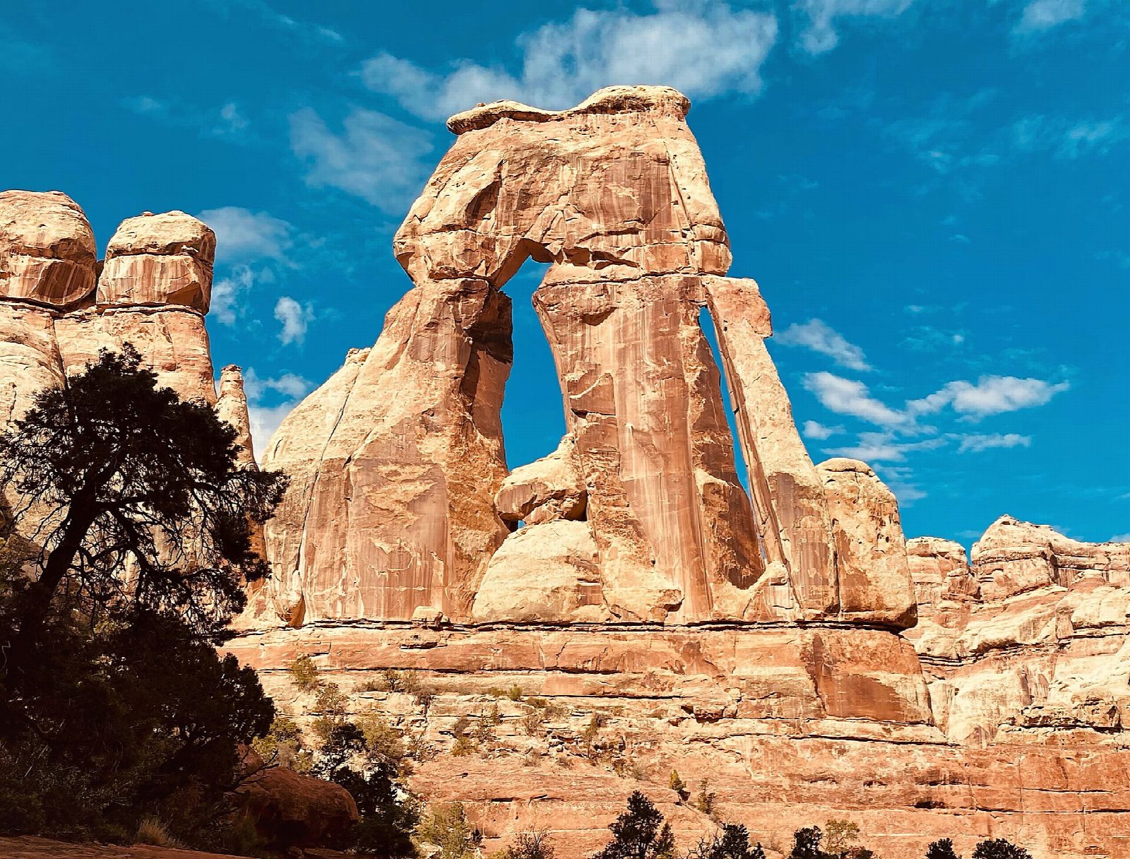
From the Elephant Hill Trailhead follow the Chesler Park Trail over slickrock benches among the banded spires of the Needles. After nearly two miles it drops into Elephant Canyon. Turn up the canyon and follow it, in and out of its sandy wash, past the side trails to Chesler Park. The last quarter of a mile climbs steeply, with one ladder and some scrambling, to a bench facing the arch. Return the same way.
It is 9.8 miles (15.7 km) round trip with 800 feet (244 m) of climbing; allow about 4½ hours. The grade is Hard: it is long, much of it in deep sand and loose rock, with a ladder and a scramble at the end. The park allows five to seven hours.
The park gives 10.8 miles for the round trip. Water sources are unreliable: carry all you need, a litre for each hour, and expect little shade. The last three miles of road to the trailhead are unpaved but passable to ordinary cars; vehicles over 21 feet are not allowed. The trailhead has a toilet, and the nearest water is at the Needles visitor center. No permit is needed for a day hike. Pets are not allowed. The Needles was closed by a wildfire from June 28 to July 18, 2026; the park's road report of September 28 shows the Elephant Hill road open.
Route drawn by Global Adventurer along OpenStreetMap paths (© OpenStreetMap contributors, ODbL), with figures worked out from it. Check the forecast and the ground on the day: paths change.
Good to know
- Up the sandy floor of Elephant Canyon in the Needles; a ladder and a scramble lead to the arch
- Druid Arch stands on the skyline like a slab from Stonehenge
- No reliable water on the way; the last miles of road to the trailhead are graded gravel
Getting there
Start: Elephant Hill Trailhead. 38.14179, -109.82721
Places to stay nearby
Rooms in and around Arches and Canyonlands: Booking.com → Expedia →
Affiliate links: if you book, Global Adventurer earns a small commission at no cost to you.
Paths change, and the weather decides the day. The line and figures come from OpenStreetMap and our own checks; take a map, check the forecast, and turn back if it isn't right.
