Line © OpenStreetMap contributors (ODbL), checked by Global Adventurer.
The walk
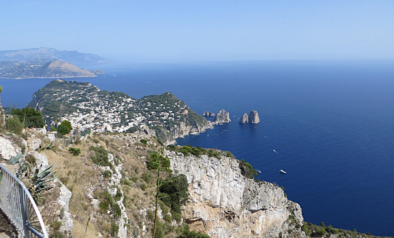
From Piazza Vittoria in Anacapri, beside the chairlift station, lanes and then a path climb south through gardens and woods to the hermitage of Santa Maria a Cetrella, 476 m, on a terrace above the sea. From the hermitage a steep, rocky path climbs west to the top of Monte Solaro, 589 m, the highest point on Capri, with the whole island, the Faraglioni and the sea spread out below. Return the same way, or take the chairlift down.
It is 5.2 km there and back with 416 m of ascent; allow about 3 hours. The grade is Hard: short, but the path from Cetrella to the summit is steep and rocky and is mapped as demanding mountain walking.
Do not go on from the summit along the ridge towards Punta Carena: the CAI grades that path for experienced hikers, above sheer drops of hundreds of metres. The church at Cetrella opens only on some days. The chairlift from Piazza Vittoria takes about 12 minutes, so you can walk one way; capri.com gives €11 single and €14 return, and hours of about 9:30 to 17:00 in September and October.
Buses run to Piazza Vittoria in Anacapri from Capri and Marina Grande.
Route drawn by Global Adventurer along OpenStreetMap paths (© OpenStreetMap contributors, ODbL), with figures worked out from it. Check the forecast and the ground on the day: paths change.
Good to know
- Monte Solaro, 589 m, is the highest point on Capri
- The little hermitage of Santa Maria a Cetrella stands on a terrace above the sea
- A chairlift runs from Piazza Vittoria to the summit in about 12 minutes, so you can walk one way
- Do not go on along the ridge towards Punta Carena: that path is exposed above sheer drops
Summits on the way
- Monte Solaro 589 m · passed close by
Getting there
Start: Piazza Vittoria, Anacapri. 40.55634, 14.22133
Places to stay nearby
Rooms in and around Piazza Vittoria: Booking.com → Expedia →
Affiliate links: if you book, Global Adventurer earns a small commission at no cost to you.
Paths change, and the weather decides the day. The line and figures come from OpenStreetMap and our own checks; take a map, check the forecast, and turn back if it isn't right.