Line © OpenStreetMap contributors (ODbL), checked by Global Adventurer.
The hike
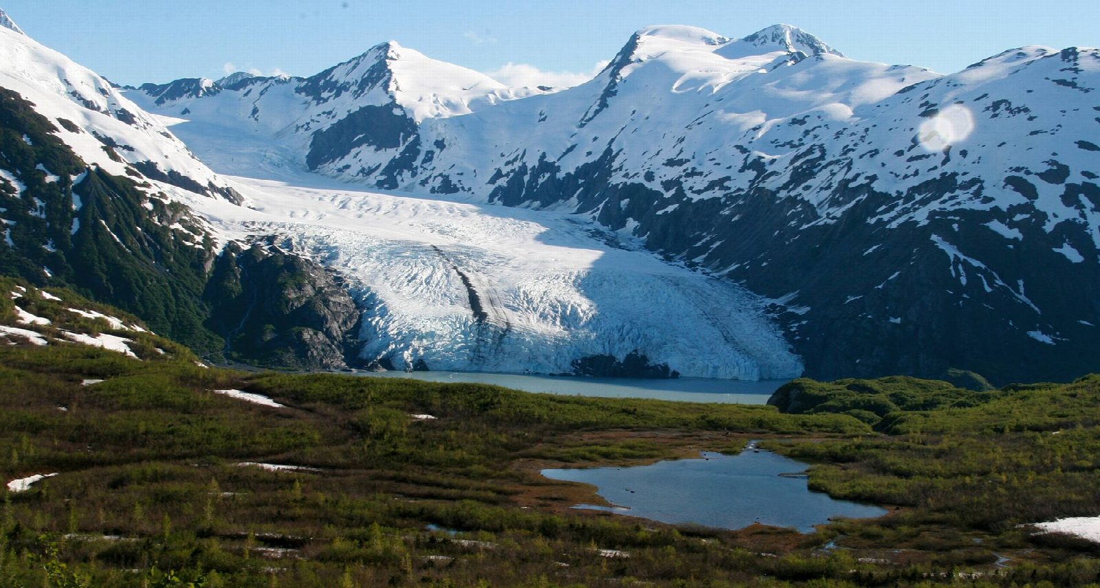
The walk starts at the Portage Pass Trailhead in Whittier: once out of the tunnel, take the first right across the railway tracks at the trail sign. The Portage Pass Trail climbs steeply up an old road for most of a mile, with Passage Canal and Whittier behind, to Portage Pass, about 800 feet above the sea. Beyond the pass the trail drops gently to Divide Lake, with Portage Glacier and Portage Lake ahead. Our line turns back at Divide Lake; the trail goes on down through brush, about three quarters of a mile, to the gravel shore of Portage Lake. Return the same way.
It is 2.7 miles (4.3 km) round trip with 770 feet (235 m) of climbing; allow about 2 hours. The grade is Easy: short, with one steep climb to the pass on a rough old road.
Whittier is reached by road only through the Anton Anderson Memorial Tunnel, a single lane shared with the railway. Cars pay a $13 toll, and each direction opens for 15 minutes in the hour. From October to April it opens towards Whittier on the half hour and back on the hour, and shuts for the night at 10:45 pm.
The pass funnels the wind and the weather turns fast: bring rain gear and a warm layer even on a fine day. Bears live here.
Route drawn by Global Adventurer along OpenStreetMap paths (© OpenStreetMap contributors, ODbL), with figures worked out from it. Check the forecast and the ground on the day: paths change.
Good to know
- Over an old crossing between Prince William Sound and Turnagain Arm to a lake facing Portage Glacier
- Whittier is reached by a one-lane tunnel shared with the railway, with a toll and a timetable
- Wind funnels through the pass and the weather turns fast: bring a warm layer
Getting there
Start: Portage Pass Trailhead. 60.77509, -148.72893
Places to stay nearby
Rooms in and around Alaska: Booking.com → Expedia →
Affiliate links: if you book, Global Adventurer earns a small commission at no cost to you.
Paths change, and the weather decides the day. The line and figures come from OpenStreetMap and our own checks; take a map, check the forecast, and turn back if it isn't right.
