The line is OpenStreetMap's mapping of the route (© OpenStreetMap contributors, ODbL), via Waymarked Trails, with heights from a 30 m terrain model. Check the current official route before a long trip: diversions and permitted paths change. See the source.
The trail
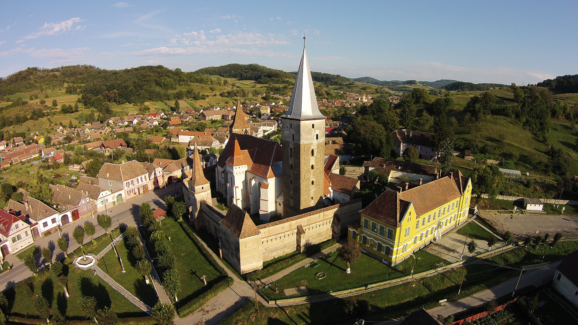
Romania's first long-distance trail, from Putna Monastery in Bucovina to Drobeta-Turnu Severin on the Danube, by Bucovina's hills and monasteries, the Saxon villages and fortified churches of Transylvania and the mountains of the Banat, with a carved stone marker about every kilometre. The line here is the main route as mapped in OpenStreetMap, 1,324 km when imported on 4 October 2026; the Via Transilvanica association puts the main route at about 1,400 km, and the whole trail, with its new branches such as Terra Borza Teutonica in Brașov county, at about 1,600 km in 85 stages, so newer sections may not be on this map yet. The days are an estimate at the association's average stage of about 19 km. Most nights are in village guesthouses and homestays listed, with numbers to book, in the trail's own guide and app; spring and autumn suit it best, as summer is hot and winter brings snow.
Planning
Notes from desk research of the sources listed below, checked 4 October 2026. They are not a first-hand account: paths, transport and rules change, so check before you go.
Which part to walk
Our line is the main route as mapped in OpenStreetMap, from Putna Monastery in Bucovina to Drobeta-Turnu Severin on the Danube, 1,324 km on our map. The Via Transilvanica association gives the whole trail as about 1,600 km in 85 stages. That total includes Terra Borza Teutonica, a 187 km branch in Brașov county, the first of the extensions begun in 2025; the association puts the main route itself at around 1,400 km, in seven regions.
With a few days, pick a run of stages within one region, such as the Saxon villages of Terra Saxonum around Sighișoara. With a week, walk a whole region: Bucovina, from Putna to Poiana Stampei, is 144 km in eight stages, and Terra Romana, from Crușovăț to Drobeta-Turnu Severin, is 143 km in seven. The whole main route takes about 70 days on our map, at the association's average stage of about 19 km.
How hard is it
The association describes the trail as accessible to first-timers as well as experienced long-distance walkers, but calls Bucovina a test for walkers, with its hills and the Mestecăniș pass, and rates Terra Dacica easy to medium. Our map shows about 54,900 m of climbing over the whole line, with a high point near 1,350 m. Navigation is helped by a carved andesite stone about every kilometre, signposts at junctions and frequent paint marks.
Getting there and back
The trail starts at Putna Monastery in Suceava county and ends in Drobeta-Turnu Severin in Mehedinți county. The association's online map marks railway stations near the route, and some of its B variants detour into larger towns with better connections for walkers ending a trip there. Variant A and B of a stage always meet again.
Where to stay and eat
The association's hiker's guide lists accommodation for each day, with phone numbers for booking, along with a map, height profile and route description. It is free to download as a PDF in English, Romanian, German, Hungarian and Spanish, or sold as a book. Its online map also shows accommodation, restaurants, shops, springs, pharmacies, cash machines and stamp points, and the trail's own app has offline maps.
When to go
The association's website does not set a walking season, and it invites walkers to start from either end and plan around the time they have. Bucovina and the Highlands cross hill and mountain country at the foot of the Călimani and Rodna ranges, so check conditions there before a winter or early spring trip. Ring ahead to book beds whatever the season.
Before you go
The association gives detailed guidance on sheepdogs guarding flocks. It asks walkers to slow down near sheepfolds, make themselves heard with a whistle, keep 50 to 100 m from the flock and detour widely even if that means leaving the trail, never run, and look for the shepherd. If dogs approach, stop, stay calm, stand side-on and avoid staring. It suggests carrying trekking poles, a whistle and an approved repellent spray as a last resort. Its guide and videos also cover wild animals, including bears. The emergency number is 112.
You can follow the line in the Global Adventurer app, free, with the map offline.
Sources: Via Transilvanica: home page (length, stages, guide and app), Via Transilvanica: regions, main route and B variants, Via Transilvanica: Bucovina, Via Transilvanica: Highlands, Via Transilvanica: Terra Saxonum, Via Transilvanica: Terra Dacica, Via Transilvanica: Terra Romana, Via Transilvanica: concept and waymarking, Via Transilvanica: the traveller's guide, Via Transilvanica: online map, Via Transilvanica: safety on the trail, Via Transilvanica: safety guidance for hikers (dogs).
Map sections
About 70 days at about 18.9 km (11.8 mi) a day, an estimate from the length. Too many to list day by day, so here the line is in 30 sections, each ending at a town or village it passes, to help you find your way along it. They are not daily stages, and they vary from 34 km to 66 km: plan your days and nights from the trail's own guide.
- Section 1 Putna to Vatra Moldoviței 36 km · 36 km from the start
- Section 2 Vatra Moldoviței to Vatra Dornei 62 km · 99 km from the start
- Section 3 Vatra Dornei to Tătaru 34 km · 132 km from the start
- Section 4 Tătaru to Mureșenii Bârgăului 41 km · 174 km from the start
- Section 5 Mureșenii Bârgăului to Orheiu Bistriței 41 km · 215 km from the start
- Section 6 Orheiu Bistriței to Gledin 47 km · 261 km from the start
- Section 7 Gledin to Cașva 36 km · 297 km from the start
- Section 8 Cașva to Câmpu Cetății 41 km · 338 km from the start
- Section 9 Câmpu Cetății to Inlăceni 50 km · 388 km from the start
- Section 10 Inlăceni to Odorheiu Secuiesc 41 km · 429 km from the start
- Section 11 Odorheiu Secuiesc to Mujna 51 km · 479 km from the start
- Section 12 Mujna to Cloașterf 42 km · 521 km from the start
- Section 13 Cloașterf to Criș 50 km · 571 km from the start
- Section 14 Criș to Moșna 47 km · 618 km from the start
- Section 15 Moșna to Copșa Mică 46 km · 663 km from the start
- Section 16 Copșa Mică to Blaj 49 km · 712 km from the start
- Section 17 Blaj to Limba 43 km · 755 km from the start
- Section 18 Limba to Pianu de Sus 40 km · 795 km from the start
- Section 19 Pianu de Sus to Ciungu Mare 46 km · 841 km from the start
- Section 20 Ciungu Mare to Prihodiște 40 km · 882 km from the start
- Section 21 Prihodiște to Râu Mic 38 km · 920 km from the start
- Section 22 Râu Mic to Bucova 47 km · 966 km from the start
- Section 23 Bucova to Glimboca 34 km · 1,000 km from the start
- Section 24 Glimboca to Lindenfeld 38 km · 1,038 km from the start
- Section 25 Lindenfeld to Reșița 50 km · 1,087 km from the start
- Section 26 Reșița to Prigor 66 km · 1,154 km from the start
- Section 27 Prigor to Prisacina 53 km · 1,206 km from the start
- Section 28 Prisacina to Obârșia-Cloșani 38 km · 1,244 km from the start
- Section 29 Obârșia-Cloșani to Marga 42 km · 1,286 km from the start
- Section 30 Marga to Drobeta-Turnu Severin 39 km · 1,324 km from the start
Start and finish
Start: near Putna, Suceava. 47.86893, 25.61210
Finish: near Drobeta-Turnu Severin, Mehedinți. 44.62449, 22.65765
Places to stay
Rooms in the towns and villages along the way:
- Putna, Suceava · The start Booking.com → Expedia →
- Vatra Moldoviței, Suceava · 36 km from the start Booking.com → Expedia →
- Vatra Dornei, Suceava · 99 km from the start Booking.com → Expedia →
- Tătaru, Suceava · 132 km from the start Booking.com → Expedia →
- Mureșenii Bârgăului, Bistrița-Năsăud · 174 km from the start Booking.com → Expedia →
- Orheiu Bistriței, Bistrița-Năsăud · 215 km from the start Booking.com → Expedia →
- Gledin, Bistrița-Năsăud · 261 km from the start Booking.com → Expedia →
- Cașva, Mureș · 297 km from the start Booking.com → Expedia →
- Câmpu Cetății, Mureș · 338 km from the start Booking.com → Expedia →
- Inlăceni, Harghita · 388 km from the start Booking.com → Expedia →
- Odorheiu Secuiesc, Harghita · 429 km from the start Booking.com → Expedia →
- Mujna, Harghita · 479 km from the start Booking.com → Expedia →
- Cloașterf, Mureș · 521 km from the start Booking.com → Expedia →
- Criș, Mureș · 571 km from the start Booking.com → Expedia →
- Moșna, Sibiu · 618 km from the start Booking.com → Expedia →
- Copșa Mică, Sibiu · 663 km from the start Booking.com → Expedia →
- Blaj, Alba · 712 km from the start Booking.com → Expedia →
- Limba, Alba · 755 km from the start Booking.com → Expedia →
- Pianu de Sus, Alba · 795 km from the start Booking.com → Expedia →
- Ciungu Mare, Hunedoara · 841 km from the start Booking.com → Expedia →
- Prihodiște, Hunedoara · 882 km from the start Booking.com → Expedia →
- Râu Mic, Hunedoara · 920 km from the start Booking.com → Expedia →
- Bucova, Caraș-Severin · 966 km from the start Booking.com → Expedia →
- Glimboca, Caraș-Severin · 1,000 km from the start Booking.com → Expedia →
- Lindenfeld, Caraș-Severin · 1,038 km from the start Booking.com → Expedia →
- Reșița, Caraș-Severin · 1,087 km from the start Booking.com → Expedia →
- Prigor, Caraș-Severin · 1,154 km from the start Booking.com → Expedia →
- Prisacina, Caraș-Severin · 1,206 km from the start Booking.com → Expedia →
- Obârșia-Cloșani, Mehedinți · 1,244 km from the start Booking.com → Expedia →
- Marga, Mehedinți · 1,286 km from the start Booking.com → Expedia →
- Drobeta-Turnu Severin, Mehedinți · The finish Booking.com → Expedia →
Affiliate links: if you book, Global Adventurer earns a small commission at no cost to you.
Paths change, and the weather decides the day. The line comes from the source named under the map and the heights from a terrain model, so treat the figures as a guide. Check for diversions before you go, take a map, check the forecast, and turn back if it isn't right.