Line © OpenStreetMap contributors (ODbL), checked by Global Adventurer.
The ride
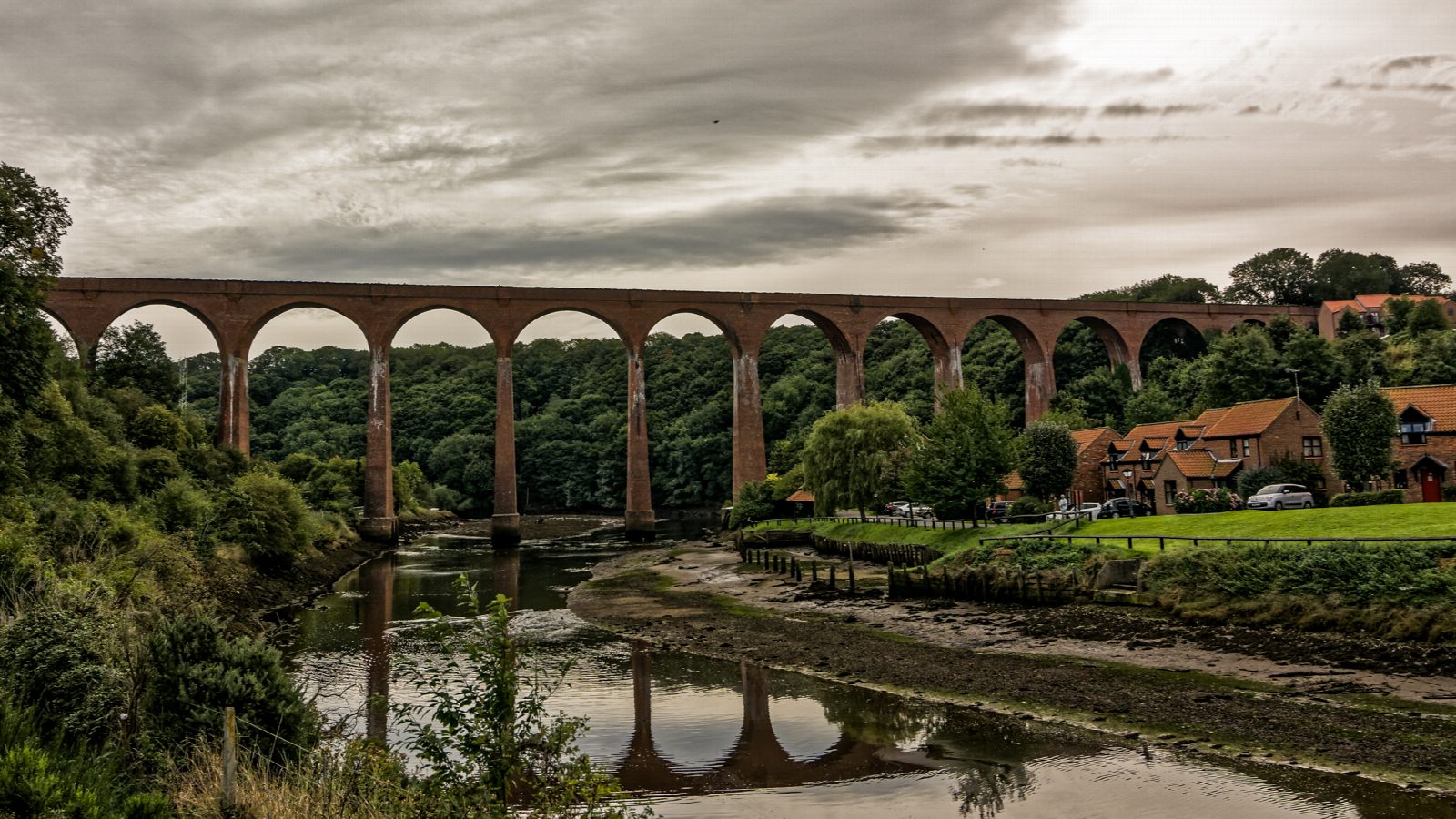
The Cinder Track is the old Scarborough and Whitby Railway, opened in 1885 and closed in 1965. From the harbour car park by Whitby station, town streets climb for 900 m to the start of the track. It crosses the Esk on the 13 brick arches of Larpool Viaduct, climbs past Stainsacre to a summit at Hawsker, crosses the A171 at a signalled crossing and then runs down the coast, with the sea below, to the old station at Robin Hood's Bay.
It is 20.9 km (13.0 miles) there and back with 171 m of climbing; allow about 1½ hours of riding. The grade is Easy. There are no steep hills, but there is a long, steady climb to Hawsker in each direction.
As its name says, the surface is cinder and stone, with tarmac near Whitby: firm in places, rough, rutted and muddy in others. It is a ride for hybrids, gravel bikes and mountain bikes rather than road bikes, and children on proper bikes will manage it better than a trailer will.
The track is traffic-free apart from the streets in Whitby and the last few metres to the station yard at Robin Hood's Bay, now a car park. Whitby has a railway station. Check before relying on the hire centre in the old station at Hawsker, which was closed when we looked.
Route drawn by Global Adventurer along OpenStreetMap paths (© OpenStreetMap contributors, ODbL), with figures worked out from it. Check the forecast and the ground on the day: paths change.
Good to know
- The Scarborough and Whitby Railway, opened in 1885 and closed in 1965
- Over the 13 brick arches of Larpool Viaduct, 36 m above the Esk
- A long climb to Hawsker, then down with the sea in view; the surface is cinder and stone, rough and muddy in places
- Town streets for the first 900 m in Whitby and a signalled crossing of the A171 at Hawsker
Getting there
Start: Whitby · Pay and display. 54.48475, -0.61319
By train: Whitby station is 0.1 km from the start.
Places to stay nearby
Rooms in and around Whitby: Booking.com → Expedia →
Affiliate links: if you book, Global Adventurer earns a small commission at no cost to you.
Paths and roads change, and surfaces vary with the weather. The line and figures come from OpenStreetMap and our own checks; ride to what you find, give way to walkers and horses, and carry what you need to mend a puncture.