Line © OpenStreetMap contributors (ODbL), checked by Global Adventurer.
The ride
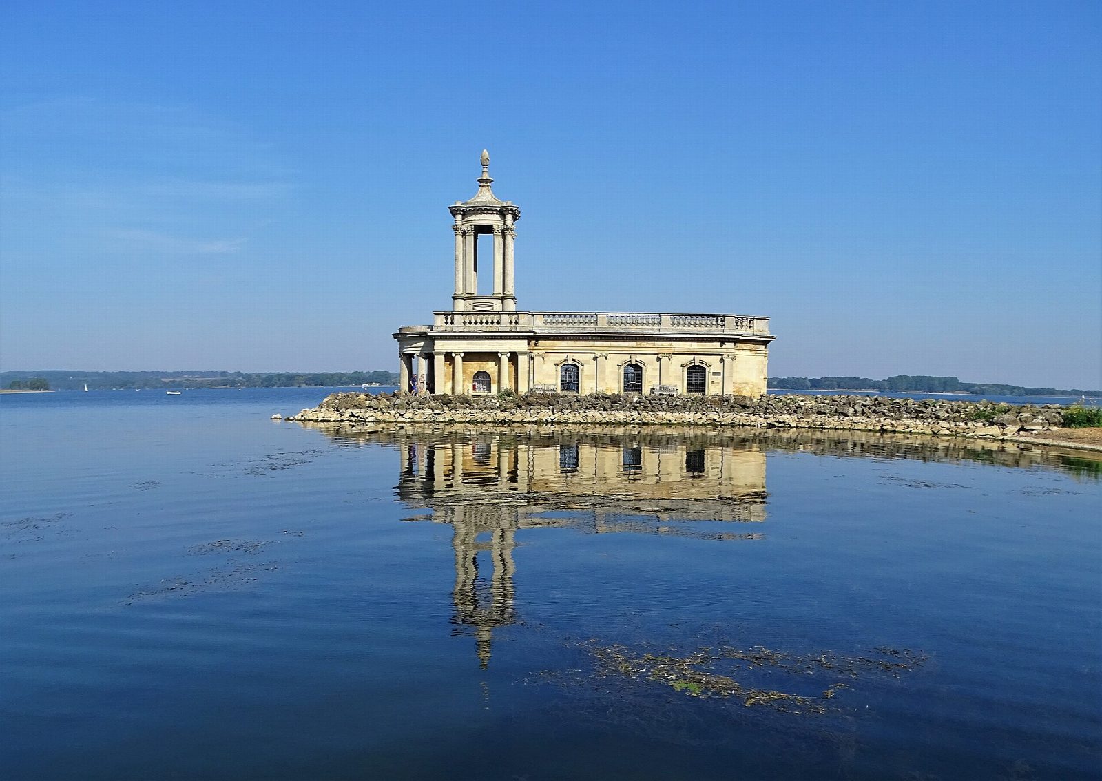
From Whitwell on the north shore the circuit runs east past Sykes Lane and across the 1,200 m dam, then west along the south shore past Normanton Church, standing at the water's edge, to Manton. It turns north through Egleton, crosses the neck of the Hambleton peninsula and returns along the north shore by Barnsdale. The reservoir was first filled in 1976.
It is 25.0 km (15.5 miles) round with 112 m of climbing; allow about 1¾ hours of riding. The grade is Easy. This lap leaves out the Hambleton peninsula, which adds about 11 km (7 miles) on mixed, hillier ground. The stretch from Whitwell to Normanton is flat tarmac, the family favourite; the rest is tarmac and bound stone, gently rolling.
Most of it is a cycle track away from traffic, good for children, trailers and most bikes. About a fifth of our line is on roads: village lanes in Manton and Egleton, access roads at the car parks, and in places the track runs beside the road. The track is shared with walkers and has a 10 mph limit.
Whitwell has a pay car park, cycle hire and a café. There are more cafés at Sykes Lane and Normanton, a pub in Manton, and toilets at the car parks, Egleton and Lyndon.
Route drawn by Global Adventurer along OpenStreetMap paths (© OpenStreetMap contributors, ODbL), with figures worked out from it. Check the forecast and the ground on the day: paths change.
Good to know
- The waymarked circuit of one of England's largest reservoirs, flooded in 1976, without the Hambleton peninsula
- Across the 1,200 m dam and past Normanton Church, half-sunk at the water's edge
- Mostly a cycle track away from traffic, with village lanes through Manton and Egleton and stretches beside the road
- Cycle hire and a café at Whitwell; cafés also at Sykes Lane and Normanton
Getting there
Start: Whitwell · Pay and display. 52.66473, -0.63561
Places to stay nearby
Rooms in and around Rutland: Booking.com → Expedia →
Affiliate links: if you book, Global Adventurer earns a small commission at no cost to you.
Paths and roads change, and surfaces vary with the weather. The line and figures come from OpenStreetMap and our own checks; ride to what you find, give way to walkers and horses, and carry what you need to mend a puncture.