Line © OpenStreetMap contributors (ODbL), checked by Global Adventurer.
The ride
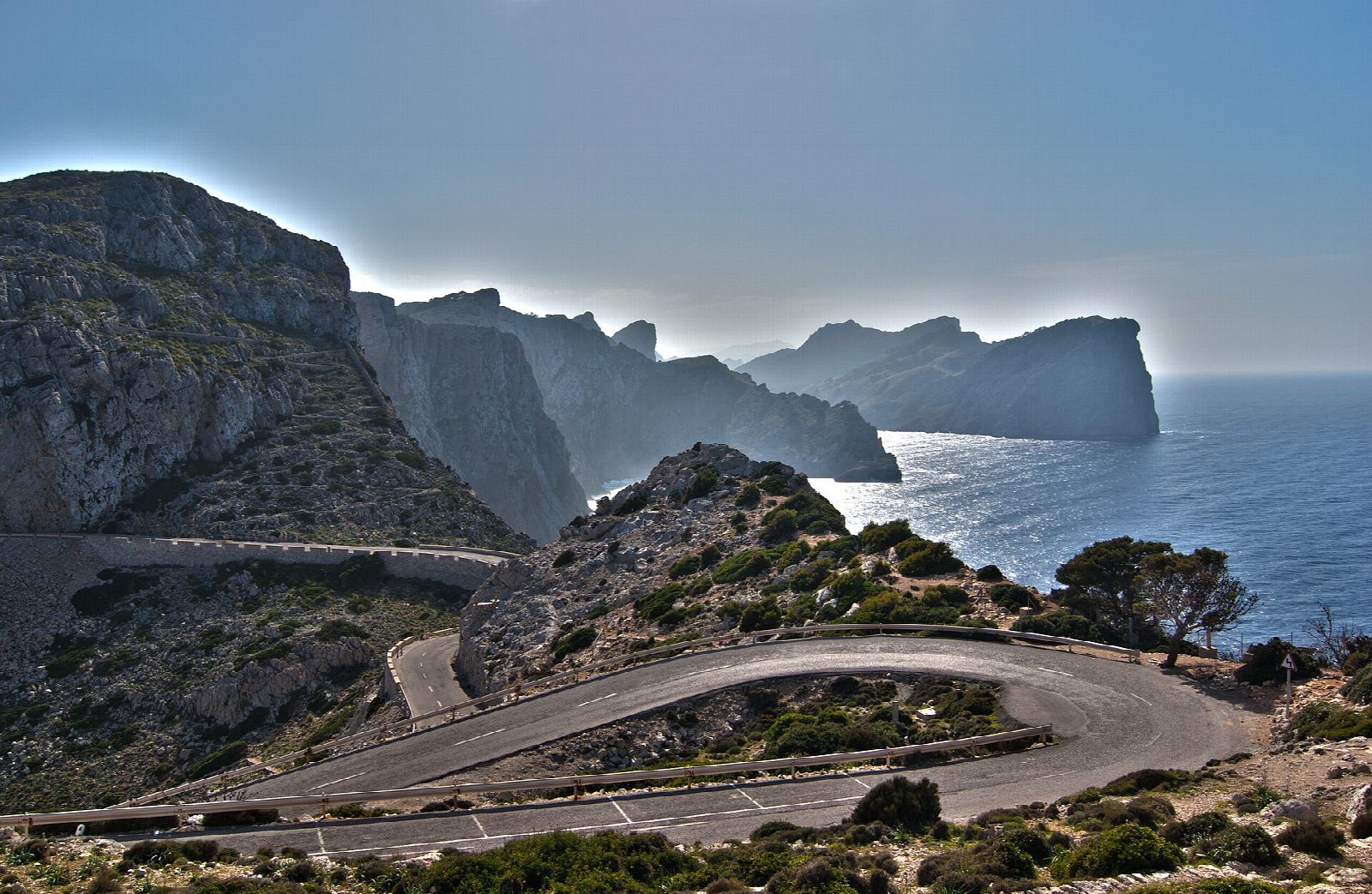
From Port de Pollença the road (Ma-2210) climbs above the bay to the Mirador des Colomer, where the sea is some 300 m below. It drops to the turning for Platja de Formentor, then climbs and falls along the peninsula above Cala Figuera and Cala Murta to the lighthouse, the Far de Formentor, on the cliffs at its tip. Come back the same way.
It is 40.3 km (25.0 miles) there and back with 790 m of climbing; allow about 2½ hours of riding. The grade is Moderate. It is all on tarmac road, with long climbs of up to about 9% in both directions; a road bike suits it best.
From 15 May to 18 October 2026, between 10am and 10pm, private cars and motorbikes may not drive beyond the beach turning towards the lighthouse, though buses and residents may; bikes and walkers are allowed. Outside those dates and hours you share the narrow road with all traffic, so ride early. Take plenty of water.
Drivers are asked to park on the service roads of the Port de Pollença ring road. The lighthouse was built in 1863; its light stands 210 m above the sea, the highest in the Balearics. The road itself was built by the engineer Antonio Parietti in 1925.
Route drawn by Global Adventurer along OpenStreetMap paths (© OpenStreetMap contributors, ODbL), with figures worked out from it. Check the forecast and the ground on the day: paths change.
Good to know
- A road ride on tarmac, climbing to the Mirador des Colomer and over the ridges of the peninsula to the lighthouse
- The lighthouse dates from 1863; its light stands 210 m above the sea, the highest in the Balearics
- The road was built by the engineer Antonio Parietti in 1925
- Come back the same way: the climbs are as steep in both directions
Getting there
Start: Port de Pollença · Pay and display. 39.90501, 3.08207
Places to stay nearby
Rooms in and around Mallorca: Booking.com → Expedia →
Affiliate links: if you book, Global Adventurer earns a small commission at no cost to you.
Paths and roads change, and surfaces vary with the weather. The line and figures come from OpenStreetMap and our own checks; ride to what you find, give way to walkers and horses, and carry what you need to mend a puncture.