Line © OpenStreetMap contributors (ODbL), checked by Global Adventurer.
The ride
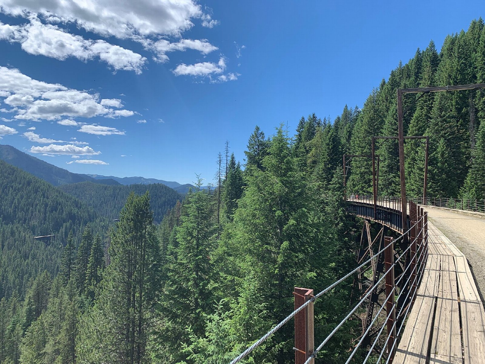
From the East Portal trailhead in Montana the ride goes straight into the St. Paul Pass tunnel, 8,771 ft (2.7 km) long and completely dark, and comes out at Roland in Idaho. From there the old Milwaukee Road railway winds down the mountainside on a steady grade, through nine more tunnels and over seven trestles, the highest of them Kelly Creek, to the Pearson trailhead.
It is 23.5 km (14.6 miles) one way with 23 m of climbing; allow about 1½ hours of riding. The grade is Easy. It loses about 300 m, so it is downhill nearly all the way, on gravel. The trestles have guard rails.
Lights are required, and 300 to 400 lumens are recommended. Helmets are required under 18. The trail is open from late May to late September and is now closed for the season (2026: 22 May to 20 September). Every rider needs a trail pass: in 2026, $20 for adults from Monday to Thursday and $40 from Friday to Sunday with the shuttle.
East Portal is 2 miles up Road 506 from I-90 exit 5 at Taft, with a large car park, toilets and bike hire (book ahead). A shuttle bus takes riders from Pearson back to Roland, then you ride the 1.8 miles back through the tunnel.
Route drawn by Global Adventurer along OpenStreetMap paths (© OpenStreetMap contributors, ODbL), with figures worked out from it. Check the forecast and the ground on the day: paths change.
Good to know
- The Milwaukee Road's line over St. Paul Pass, built between 1906 and 1911, electrified in 1917 and abandoned in 1980
- Ten tunnels and seven high trestles; the first tunnel is 8,771 ft (2.7 km) long and dark, so lights are required
- A shuttle bus climbs back from Pearson to Roland, then you ride 1.8 miles back through the long tunnel
- Food and toilets at East Portal and Pearson; bike hire at East Portal (book ahead) and at Lookout Pass
Getting there
Start: East Portal. 47.39734, -115.63458
Places to stay nearby
Rooms in and around Idaho Panhandle: Booking.com → Expedia →
Affiliate links: if you book, Global Adventurer earns a small commission at no cost to you.
Paths and roads change, and surfaces vary with the weather. The line and figures come from OpenStreetMap and our own checks; ride to what you find, give way to walkers and horses, and carry what you need to mend a puncture.