Line © OpenStreetMap contributors (ODbL), checked by Global Adventurer.
The paddling route
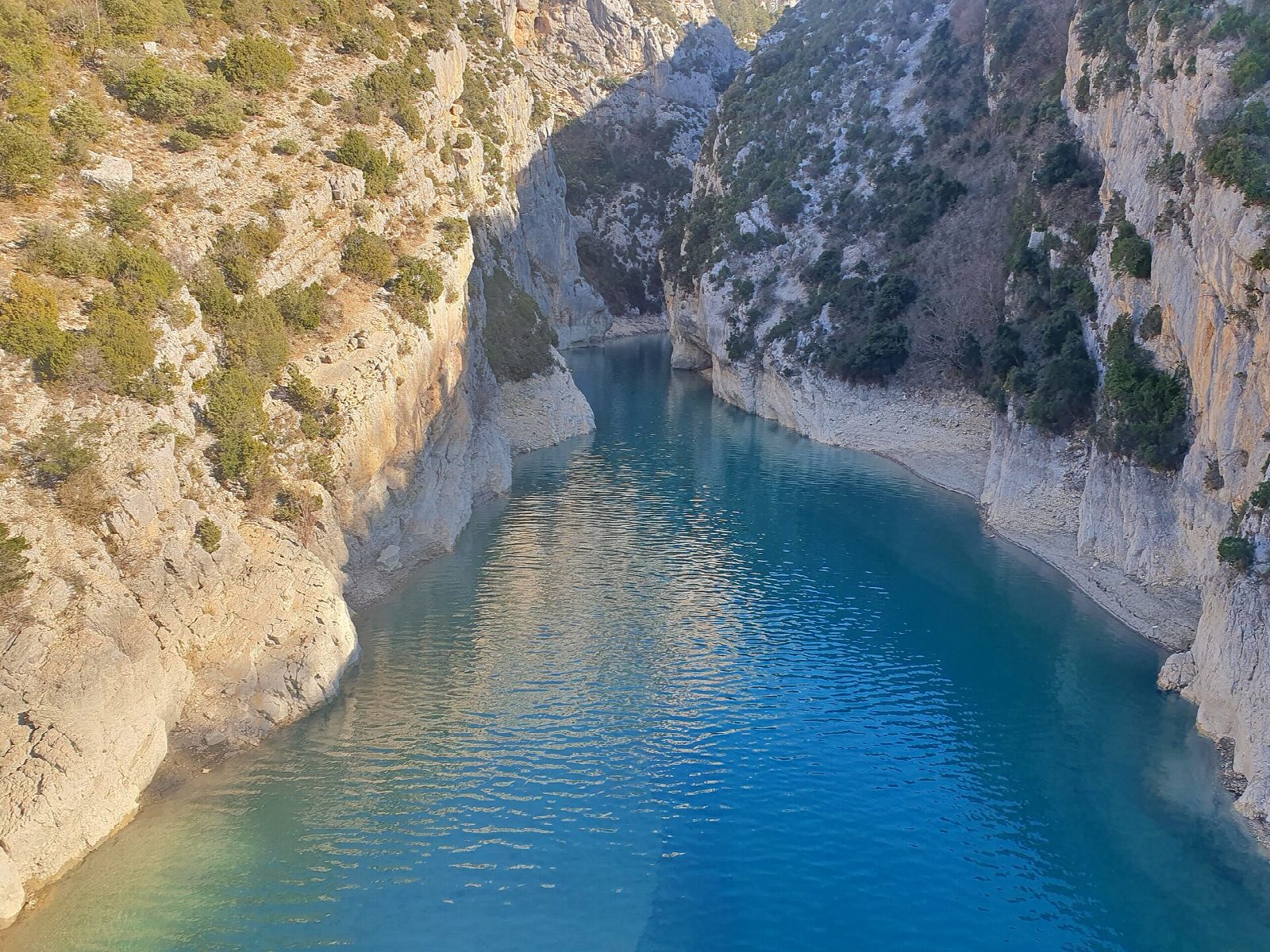
Put in from the gravel beach beside the Pont du Galetas, where the Verdon leaves its canyon for the turquoise Lac de Sainte-Croix, and paddle under the bridge and up into the gorge. The lower end of the canyon was flooded when the Sainte-Croix dam was built, so the water is still and deep green between white cliffs that rise straight out of it. After about 2 km, turn before the line of yellow buoys that marks the limit for boats: beyond it the river is kept for the apron, one of Europe's rarest fish. Come back the same way.
It is 4.2 km there and back; allow about an hour in a canoe or kayak and 1¼ on a paddleboard. The grade is Very easy: still, sheltered water with no current to speak of.
A buoyancy aid is compulsory here on canoes, kayaks and paddleboards. Inflatable craft, including inflatable paddleboards, are banned in the gorge, and it is closed to all boats when the wind is over 28 km/h. In July and August it is packed with pedalos and electric boats, so go early or out of season, keep right, and do not linger under the cliffs, where rocks can fall. Turbines at the dams can start at any time and make currents near them. Wear a buoyancy aid and check the conditions before you set off.
Route drawn by Global Adventurer along OpenStreetMap waterways (© OpenStreetMap contributors, ODbL), with figures worked out from it. Check the forecast and the ground on the day: paths change.
Good to know
- Up the flooded mouth of the Verdon gorge between limestone walls
- The Pont du Galetas marks where the Verdon leaves its canyon for Lac de Sainte-Croix
- Boats may go only as far as a line of yellow buoys: beyond it the river is kept for the apron, one of Europe's rarest fish
- The lake was made by the Sainte-Croix dam in the early 1970s
On the water
- Put in: Pont du Galetas, beach on the Aiguines side (beach) 43.80135, 6.24880
- No locks or weirs on the way.
- Rules and licences: Parc naturel régional du Verdon. Check whether you need a licence before you go: on many inland waters in England and Wales you do, and Paddle UK membership includes one for many of them.
- Suits canoes, kayaks, paddleboards.
Getting there
Start: Pont du Galetas, beach on the Aiguines side. 43.80135, 6.24880
Places to stay nearby
Rooms in and around Pont du Galetas: Booking.com → Expedia → Hotels.com →
Affiliate links: if you book, Global Adventurer earns a small commission at no cost to you.
Water levels, flow and the weather decide the day. The line and figures come from OpenStreetMap and our own checks; wear a buoyancy aid, check the river levels and the forecast, keep well clear of weirs and powered boats, and don't go out in flood.